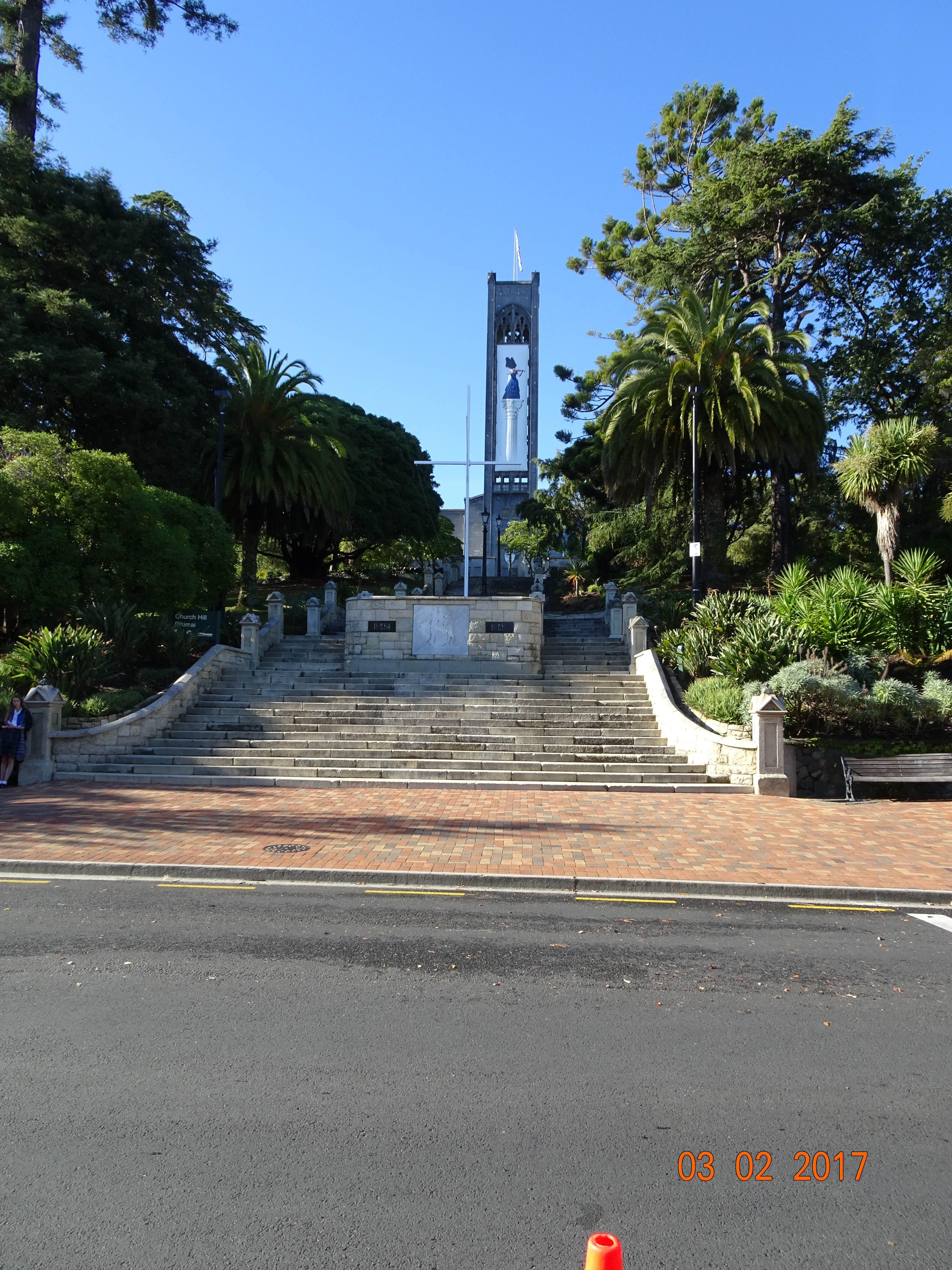
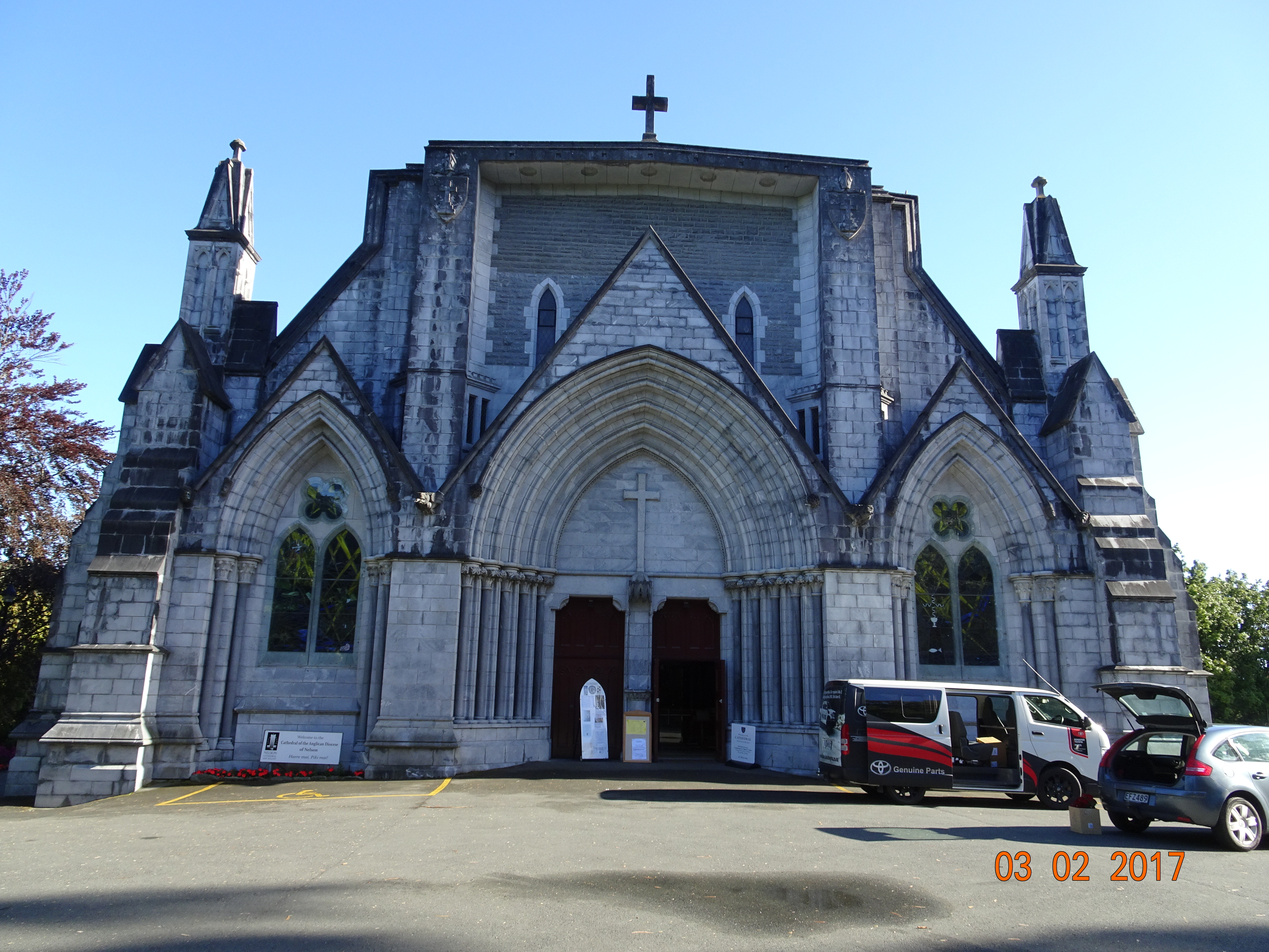
First thing in the morning we were up and out, taking the 8:30 bus into the centre of Nelson. Armed with our trusty tourist map we immediately got lost, but we did see quite a bit of the city that way. And what a nice city it is. The streets are wide and clean, there’s a good mix of old and new buildings, and we had the best blueberry muffin ever at Yaza on Hardy Street. Getting back on track, we found Trafalgar Street and went to explore the reason why little Nelson is a city – Christ Church Cathedral. There are a lot of steps to get up to the cathedral, but it is worth it, both for the view and to look around.
Cathedral stepsChrist Church Cathedral
Next on the agenda was to travel to the centre of New Zealand, which just happens to be on top of a hill. There is good signposting to the start of the track, but when you get there you find two tracks going in opposite directions and no signposts. We saw some people coming down from the left-hand one so I asked if they’d just come from the centre of New Zealand. In a broad American accent the guy said “Yes, but it doesn’t matter which track you take as long as it’s going up”.
So up we went. The track zig-zags up the hill, sometimes quite steep and other times steeper. Every now and then you emerge from the shrubbery to increasingly panoramic views of Nelson and the surrounding area. We finally made the top, where there’s a concrete and steel marker. There is also a magnificent vista – and a photo telling you what you’re looking at.
Centre of New Zealand
After that, the only way is down. There are two paths, neither of them marked, so we decided to be adventurous and take the other one. This was very narrow and had a sheer drop on the left for the first 30 metres or so. Then it joined up with the path we’d walked up. Determined not to go back the same way, we got out our map at the next junction to see where Maitai Valley is. Someone immediately stopped and asked if we needed help – this happens a lot in NZ! She told us where the Maitai track comes out, so off we went. And at the next junction found ourselves on the original track. We persevered and did eventually get to Maitai Road, from where we walked back to the cathedral.
By now we’d overdosed on spectacular views, so we grabbed a 2 bus to Annesbrook to visit the World of Wearable Art and Classic Cars Museum – yes, it really is a thing. There’s an annual Wearable Art show in Wellington, and the museum displays past entries from the show. Describing some of them as either wearable or art is stretching a point, but there were some very clever designs.
The classic car part is in two large building that were previously used to manufacture Triumph and then Honda cars. The cars date from 1908 to the 70s, with the odd new one thrown in for good measure, and they’ve been meticulously restored to their former glory.
50s Messerschmitt
Then it was the bus back into town and a 2km walk back to the campsite.
And today’s weird road-sign; at a point where two lanes become one, the instruction “Merge like a zip”!
For the first night in ages Ermintrude was quiet because we didn’t have rain thumping on the roof. However, at some point in the early morning, I heard a faint beep. Ermintrude’s router does that if it loses internet connection. I checked and there was no problem with the connection. I rebooted the router, but still the beeping. Then Diane woke up and she heard it too. We checked out phones, but they were both charged, as was the laptop. I even checked the mouse! Eventually we traced it to Ermintrude’s phone. Mystery solved!
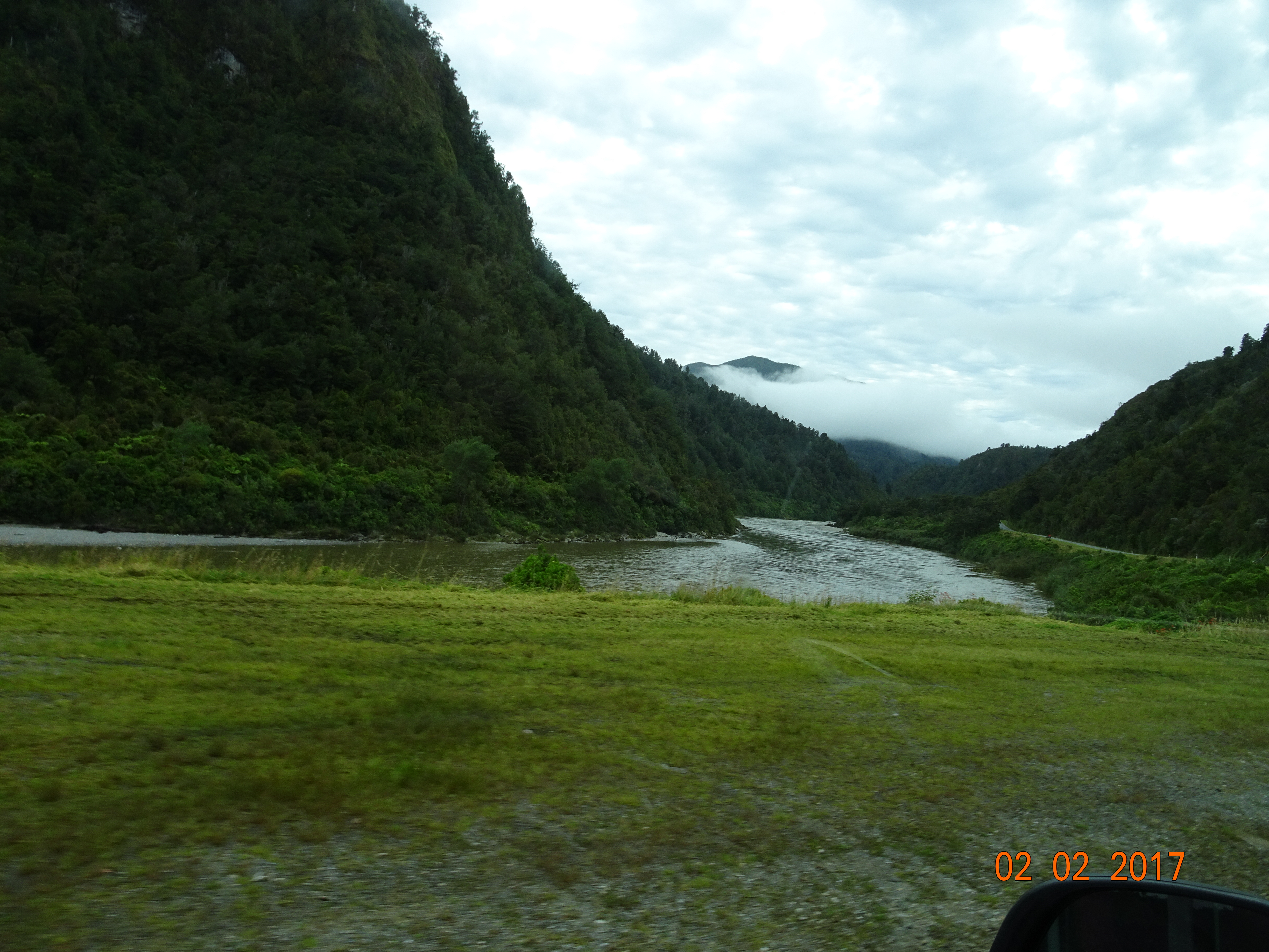
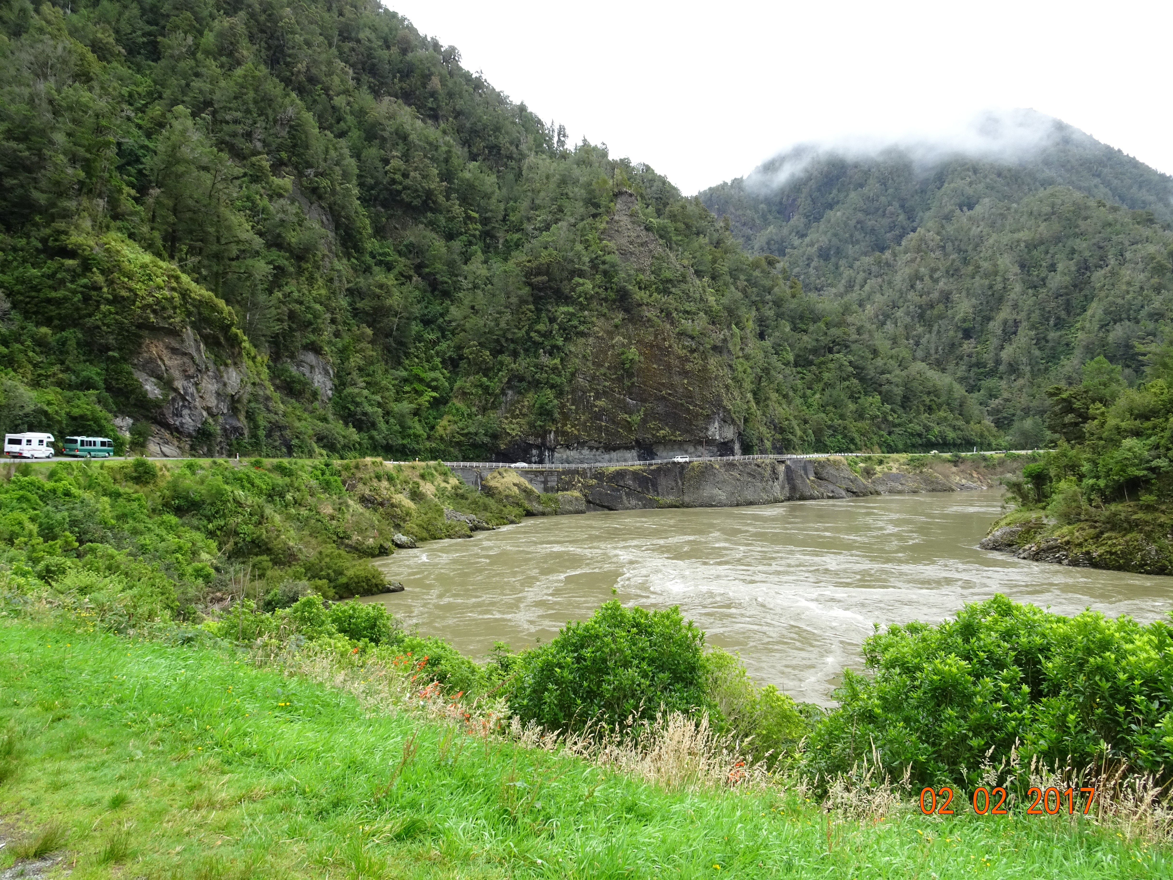
Leaving the site we were once more in “Wow” country. SH 6 runs through the Buller Gorge, with the white waters of the river flowing majestically through it and densely wooded slopes on either side. However, there were so many roadworks along this stretch that it began to feel like the M1.
Buller River
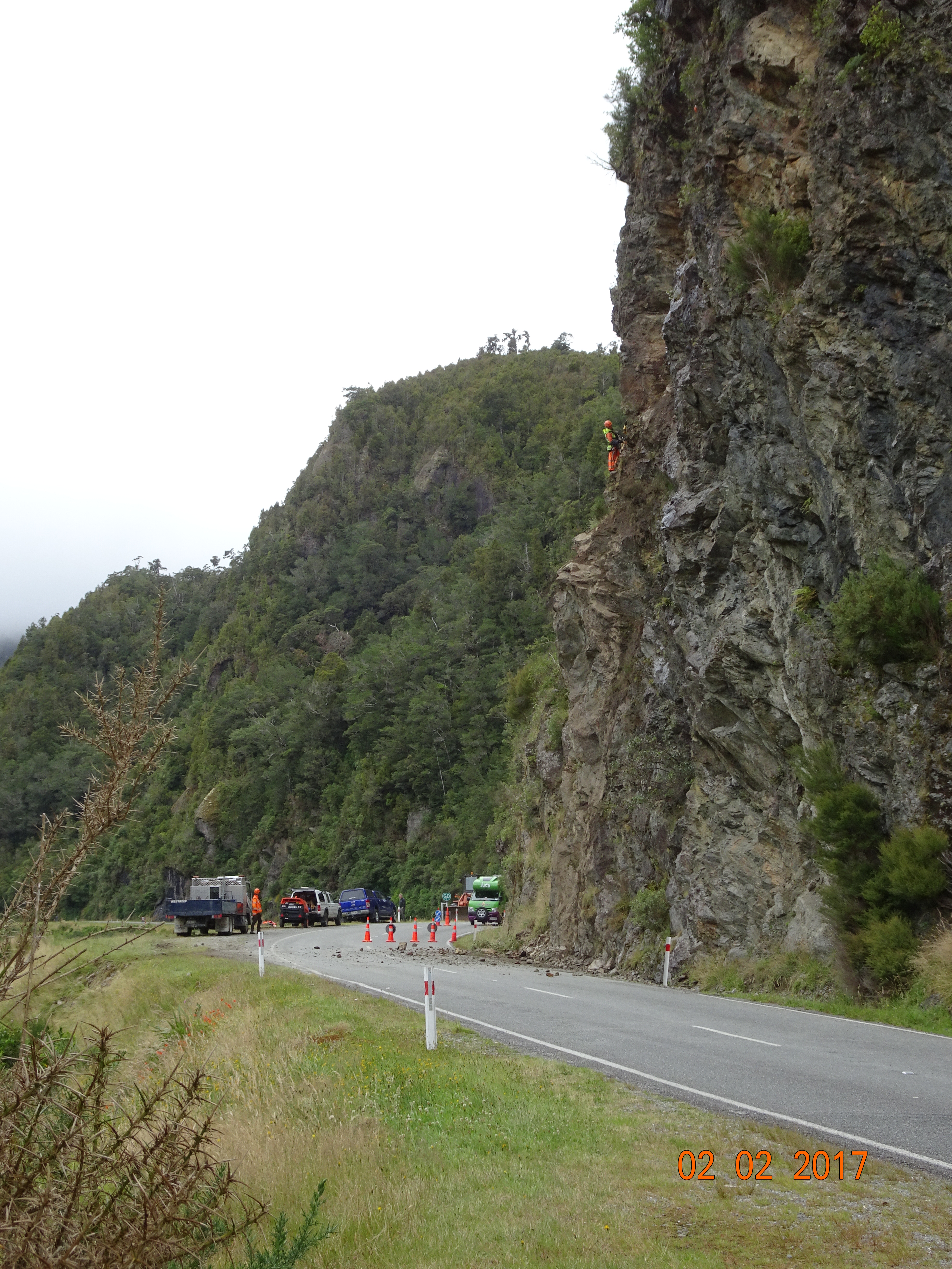
As we approached one section, on an S-bend, there was a stop/go board firmly planted in the road. A workman told us we’d be here for a while because they were clearing loose stones from the cliff as the road was part of the route for an upcoming marathon. We walked round the curve to see what they were doing. There were a couple of guys abseiling down the cliff and basically smacking the rocks with a hammer. If anything was loose it fell down onto the road.
Keeping the roads safe
We were there about 20 minutes. When we finally set off, we were third in a long line of vehicles, for which I was quite glad. There were several single lane sections, so tucked in behind two cars I didn’t have to worry too much about traffic coming the other way. One section was literally a ledge hacked out of the cliff and overhung by rock – and there were double trailer trucks coming the other way! I gave up my position in the convoy to get a photo of it.
Some of the warning signs were quite amusing. There was one saying “Shoulder Closed”; the shoulder had broken off and dropped into the river. And I couldn’t work out what the one saying “Slumps” meant!
We stopped for a coffee at Murchison which is a very industrialised ribbon development, rather than the little town we were expecting. Then it was back to hairpin bends and steep climbs until we came to a warning sign for steep hill. Rounding a bend, we found ourselves on an open plain with the road going downhill in a straight line for about 2km. What took all morning to get up took a couple of minutes to get down.
After that, the remaining route to Nelson was relatively uneventful. We’re in Nelson City Top 10, just a couple of km from the city centre, which we’ll be exploring tomorrow.
So it rained all night. When we got up in the morning all you could see was grey. For the first time when we left the campsite we didn’t say “Wow, look at that!” because there was nothing to see; everything was covered by cloud/mist.
Taking advice from weather forecasts and locals we decided there was no point hanging around. Nothing was going to change for two days, so we made for Westport in one day instead of three. From here we’ll turn east to Nelson and work our way back to the east coast.
The road was a mix of good, straight stretches interspersed with steep, hairpin bendy bits. And for the first hour we also had the occasional flood to contend with. The thick vegetation on either side of the road gradually started to give way to scrub and fields of sheep or cattle.
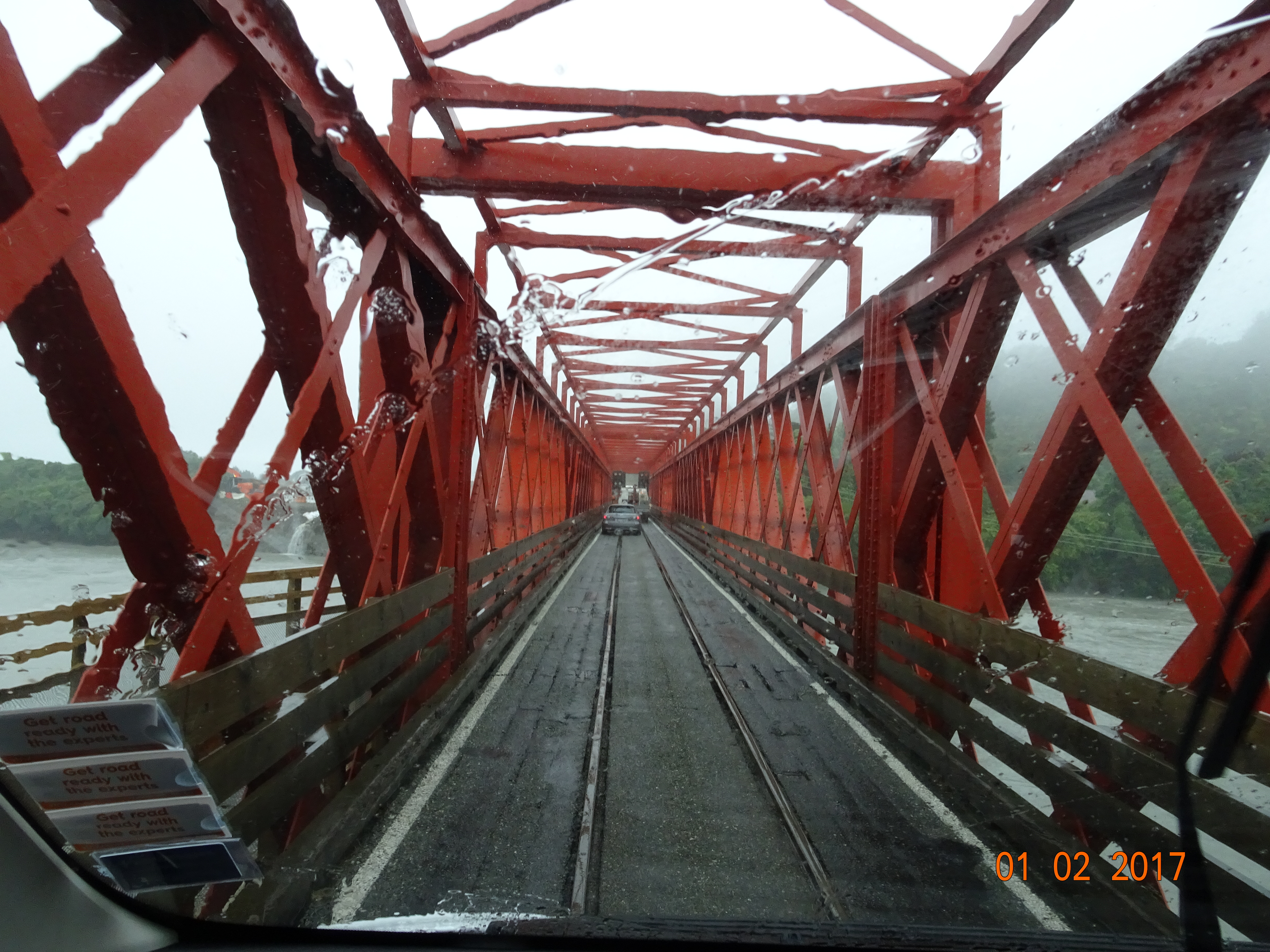
From Ross, an old gold mining town where we stopped for coffee, the road pretty much follows the coast; what you could see was wild and craggy. Shortly after that we encountered a new hazard; the single lane bridge also carries trains! And then at Kumara junction the railway goes right through the roundabout!
The one large place on our route was Greymouth and it did live up to its name, being pretty grey.
Punakaiki is home to the pancake rocks and blowholes, but we couldn’t get near the car park. Instead we stopped a little further on for a fish and chip lunch at a small restaurant. The road from there was quite hair-raising. This section of hairpin bends was up in the clouds! At least you couldn’t see down below.
So now we’re sitting in our site in Carter’s Beach, just outside Westport. The rain has finally stopped and we’re expecting some sunshine this evening.
We were up early this morning and on our way by 8am to try to avoid the 300mm of rain predicted for Haast this evening.
Leaving Wanaka on SH6, the first thing you notice is that the road is narrower and without shoulders. It is also peppered with single lane bridges and has very few passing lanes.
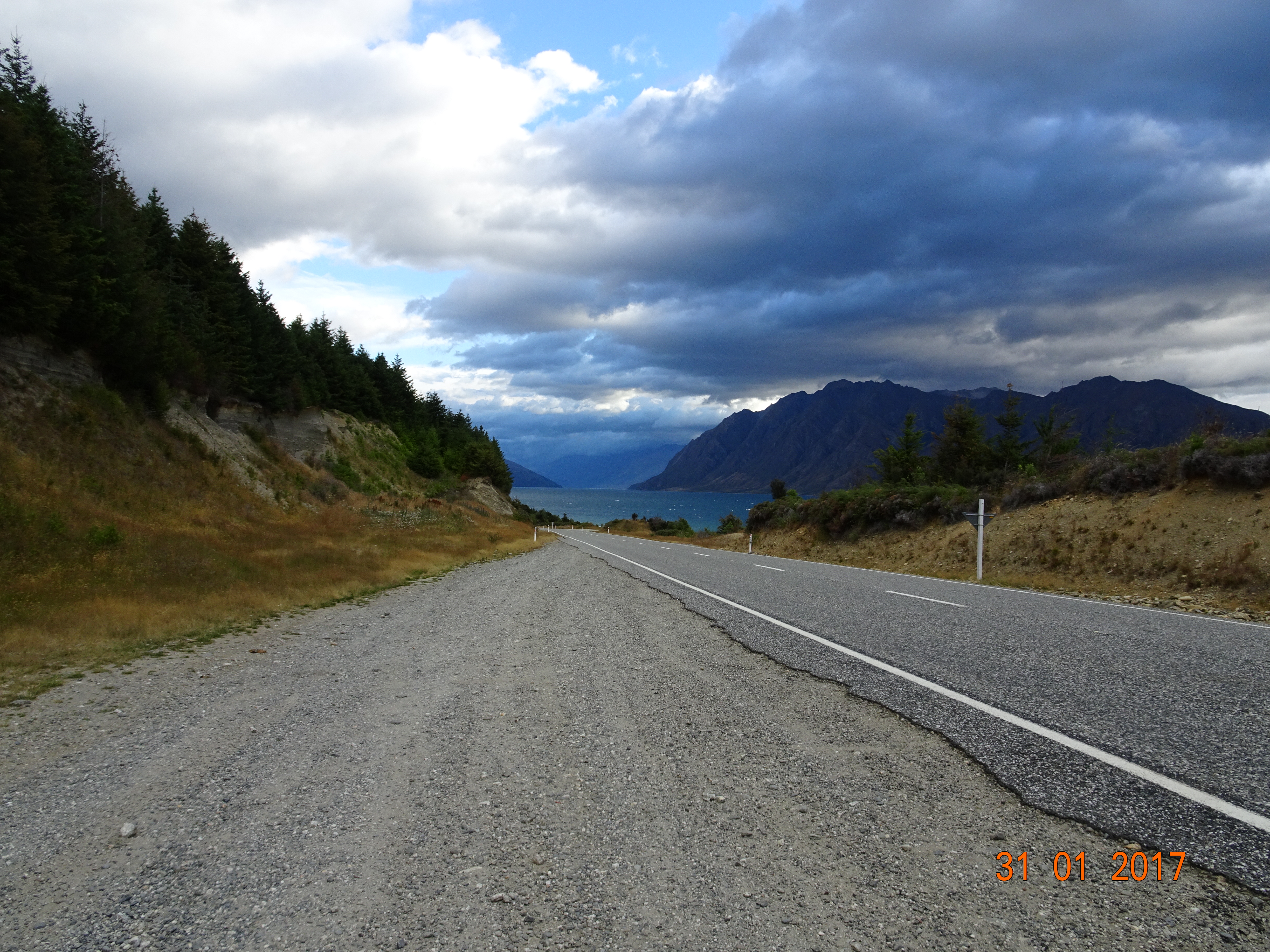
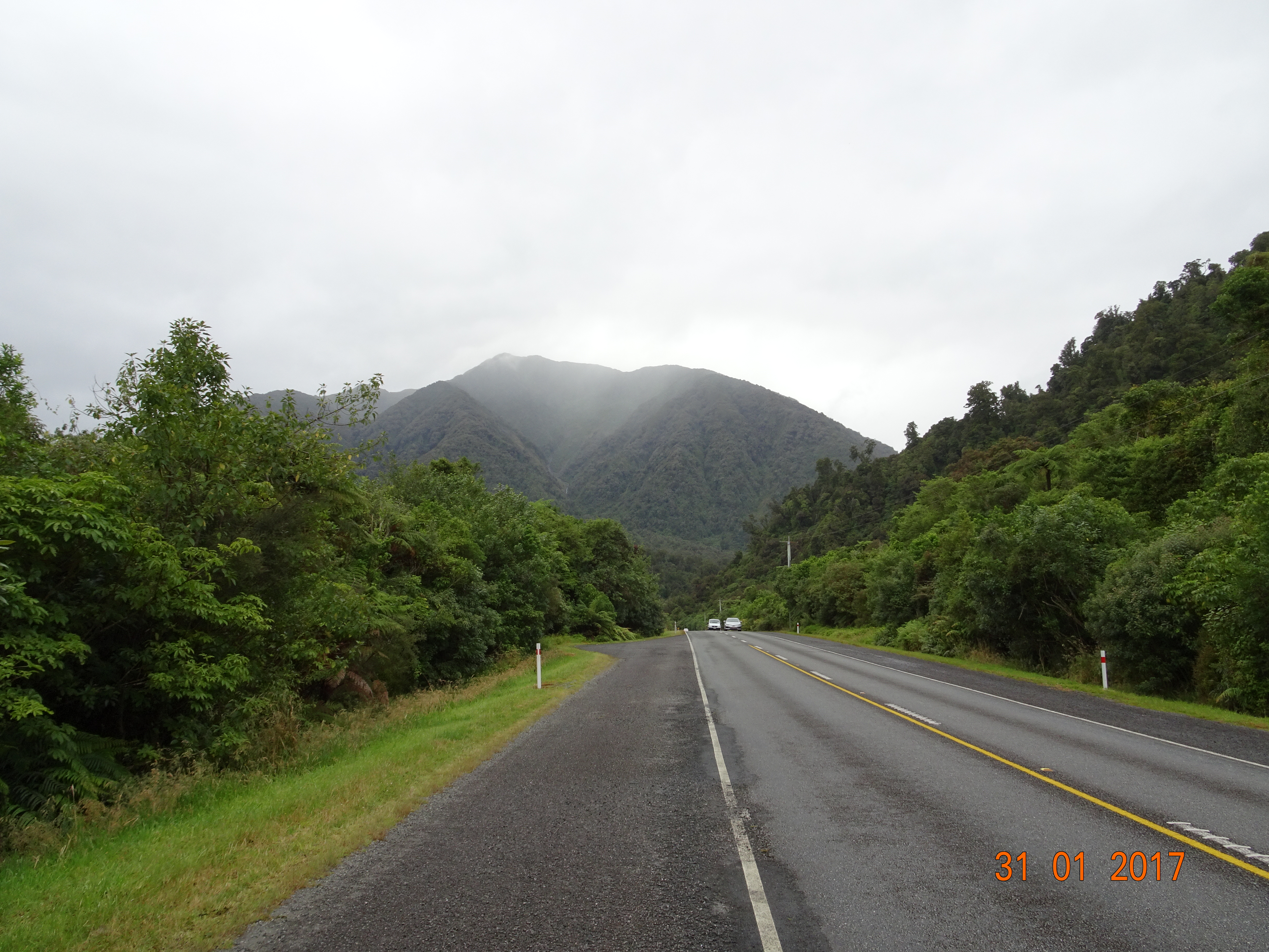
Again we were overawed by the scenery, which included some very brooding mountains at the start of the day. For the first half hour or so we roller-coastered beside a cliff with Lake Hawea on our right. Just as we got to the top of the lake we took a right hand bend and had Lake Wanaka on our left for the next half hour.
By this time the rain had set in and the mountains were shrouded in cloud. We stopped at the Makarora Country Club – basically, a petrol station with café and camping – for a coffee and snack before pressing on into Westland.
Shortly afterwards we came to a sign saying “Gates of Haast” just before a single lane bridge with a latticework of girders closing the road in. It felt like something out of a horror movie! There were even gates for closing the road in bad weather and frequent cattle grids – known as cattle stops out here. This was the Haast Pass, the route from Wanaka to the West Coast. It is noted for its spectacular scenery, but we couldn’t see anything, even on the odd occasion when we stopped somewhere. The exception was when we saw two waterfalls literally hanging in mid-air. The mountain they were flowing down was hidden by cloud and practically invisible.
Towards the end of the Pass the vegetation started to become quite tropical; from here north is the rain forest. The road straightened out, in both dimensions, so we made it fast past Haast (try saying that quickly when you’ve had a few!), which was welcome because our average speed for the morning had been about 45kph. The road runs beside the Tasman Sea for a while, but then it turns back inland and starts twisting and turning again.
Still, we made good progress and when we came to Fox Glacier we decided to divert to the viewing point. There’s a 4km track leading to a gravel road car park from where you can just get a sight of the glacier. It’s another 1km walk to get to the glacier itself, but as there was a weather warning we decided to give it a miss.
The final part of our journey was the most challenging of the day. The road between Fox and Franz Josef Glaciers winds up and down for about 25km. However, we made it safely through and we are now sitting in a snug site in the rainforest – where it is raining heavily.
Heading north on SH6, we were again struck by the magnificent views. They might all be mountains, but each one is spectacular in a different way. At one point today the road clung to the side of a cliff with a river on the other side and steep wooded slopes beyond that. At other times we drove between herds of sheep or cattle, there was a mountain-ringed plateau, a lake and fruit orchards and for most of the day immaculate rows of grape vines. You can’t get tired of the variety this place has to offer.
As you drive in NZ, you notice that all the little streams and culverts you cross are named. Today we met Gentle Annie, followed shortly afterwards by Roaring Meg. We had to wonder if they were related.
Our first port of call was the Gibbston Valley Winery. We’d intended to stop at Chard Farm, but I thought the gravel road up to the estate would be too much for Ermintrude. Diane had a tasting of three local wines, a Sauvignon Blanc, a Pinot Gris and a Pinot Noir, all of which were very acceptable. The tasting notes for the Pinot Noir included the phrase “a slither of barrel funk”; pretentious wine buffs exist the world over! I didn’t indulge as we were on another challenging road, but my coffee was the best I’ve had since we arrived in NZ.
It was a lovely sunny day so we made good time to Lake Wanaka and checked in to the Kiwi campsite. After the mega-site at Queenstown, this was lovely; good sized pitches, well spaced and first class amenities. There’s even a spa and sauna, and our pitch was surrounded by lavender plants in full bloom.
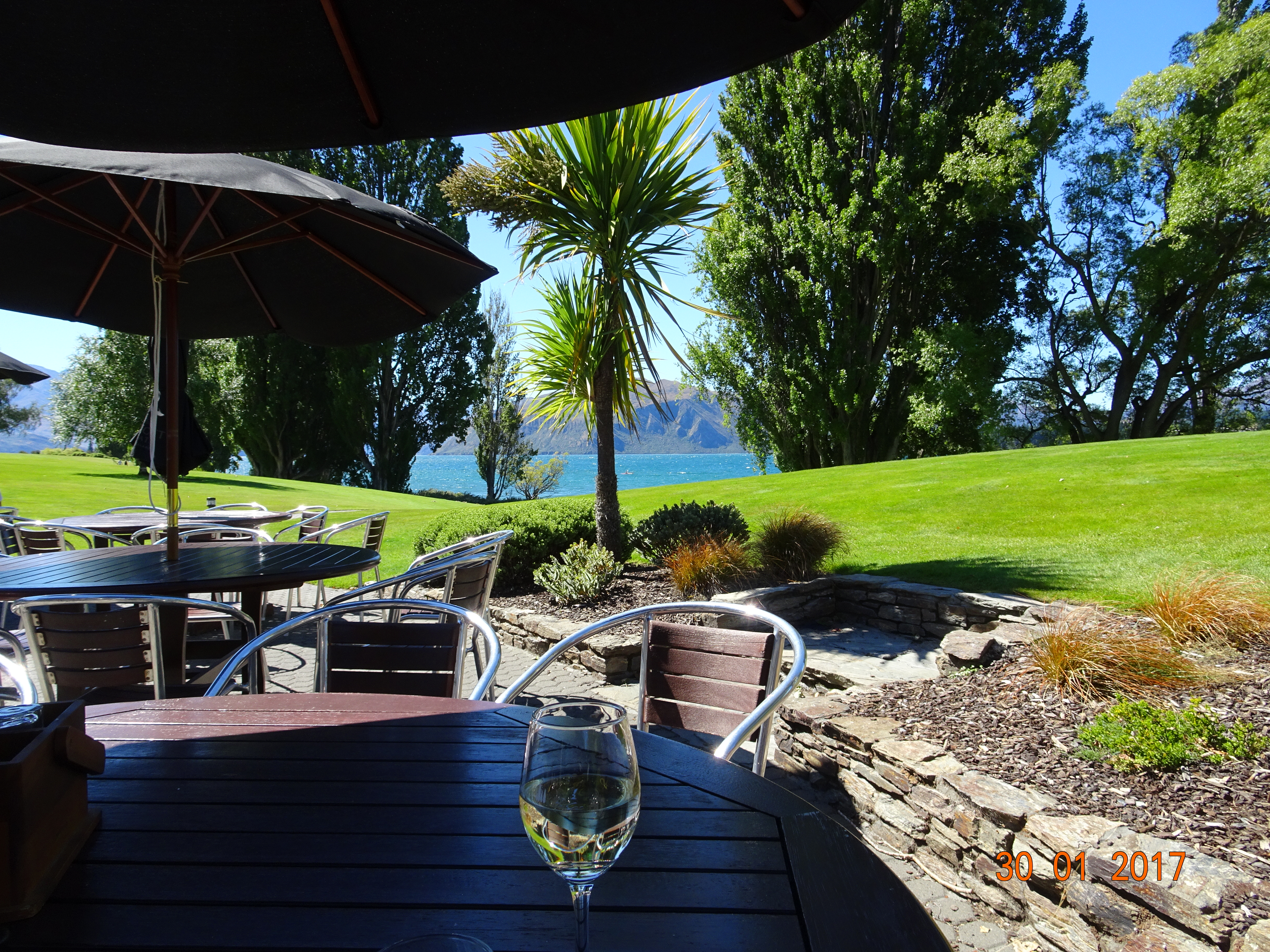
We set out to walk the Waterfall Creek Track, along the shores of the lake. The lake is the fourth largest in NZ and the waters are crystal-clear. Walking back, we stopped off at Edgewater resort for a glass of wine by the lakeside.
Wine by the lakeside
After that we strolled into the town of Wanaka. This is another modern resort town but smaller and much nicer than Queenstown. And we had our first Indian meal of the holiday in the Spice Room.
We’d been wondering how far to travel tomorrow, because it is expected to be very wet again for the next two days, so when we got back to the site we went into reception and had a chat to Andrea, the site owner. She was very helpful, looking up weather forecasts and telling us about things to do on the way. In the end we decided we’d head straight for Franz Josef, which is further than we normally do in a day, but will avoid the heavier rain expected tomorrow night at Haast, our other possible stopping place.
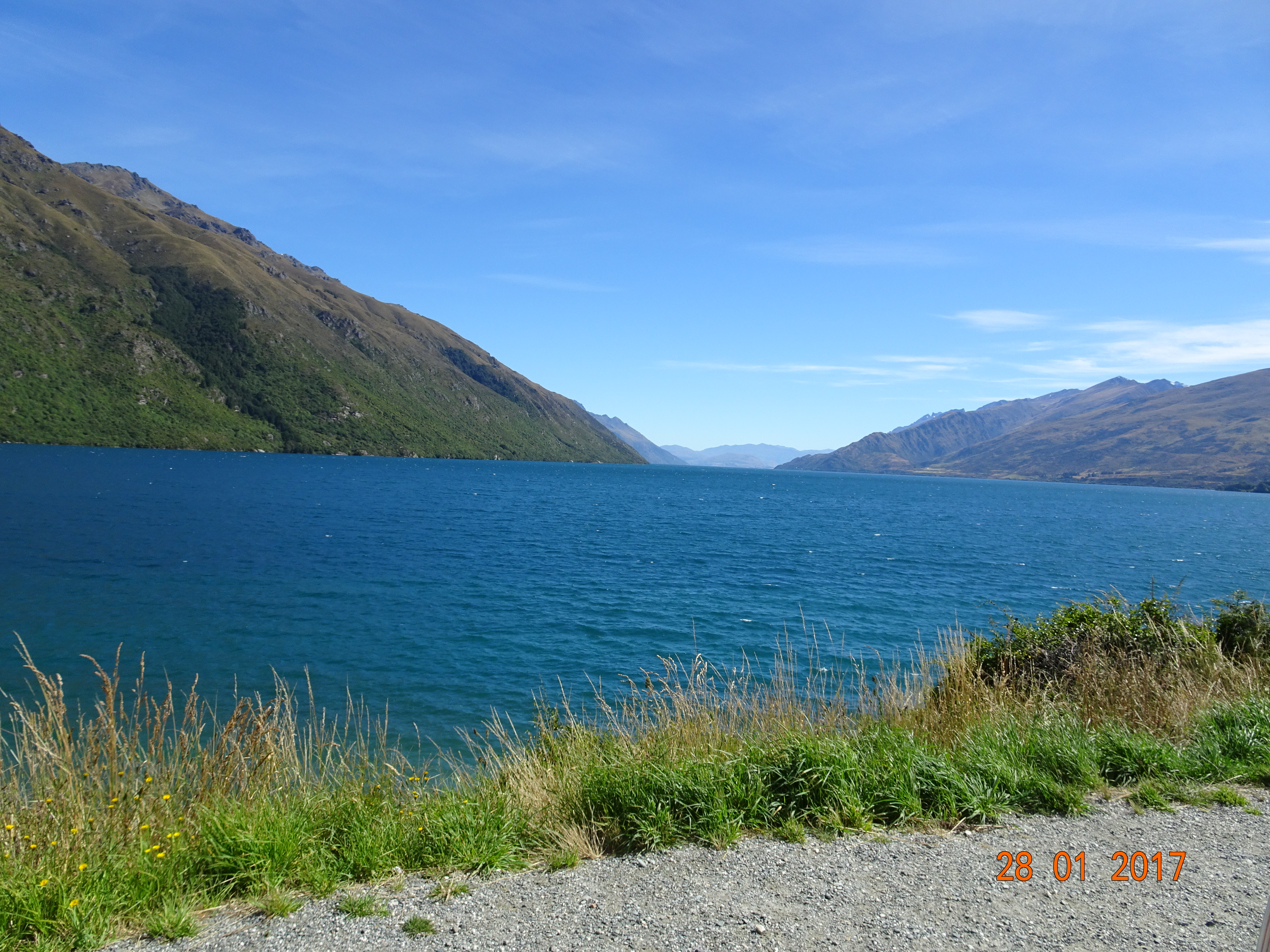
The sun really was shining in the morning so we set off for Queenstown. We had to go back to Lumsden before turning north onto Highway 6, which runs all the way down the west coast of the island from Picton to Bluff. Again we were greeted with some spectacular views, particularly for the last 40km when the road runs between mountains and Lake Wakatipu.
Lake Wakatipu
This is the longest lake in NZ, being 80km long and it is surrounded by mountains, including the Remarkables range, which really are. In the cinema it’s been used as Loch Ness as well as scenes for Lord of the Rings; in fact, in this area you’ll find bits of Lothlorien, Isengard, Ithilien, Anduin and several other Tolkein places.
Queenstown lies in a bay about half way up Wakatipu. The site we were aiming for is right in the centre of town, which was incredibly busy by NZ standards. We later found out that Queenstown always fills up at the start of the Chinese New Year; and we thought they’d all come out to welcome us!
Walking around the town we could have been in any modern holiday resort – apart from the large body of water and snow-capped mountains that are always close by. By the harbour there was a street market, complete with fire-eater/juggler; it was just like Covent Garden!
Queenstown Gardens lies in a piece of land that juts out into the lake opposite the harbour. We took the 2km walk along the lakeside, from where we watched the TSS Earnslaw, a vintage steamship, returning to the harbour. In the mouth of the bay, there are four telegraph poles stretching about ¾ of the way across to power some kind of marker; maybe they don’t get enough solar power in winter.
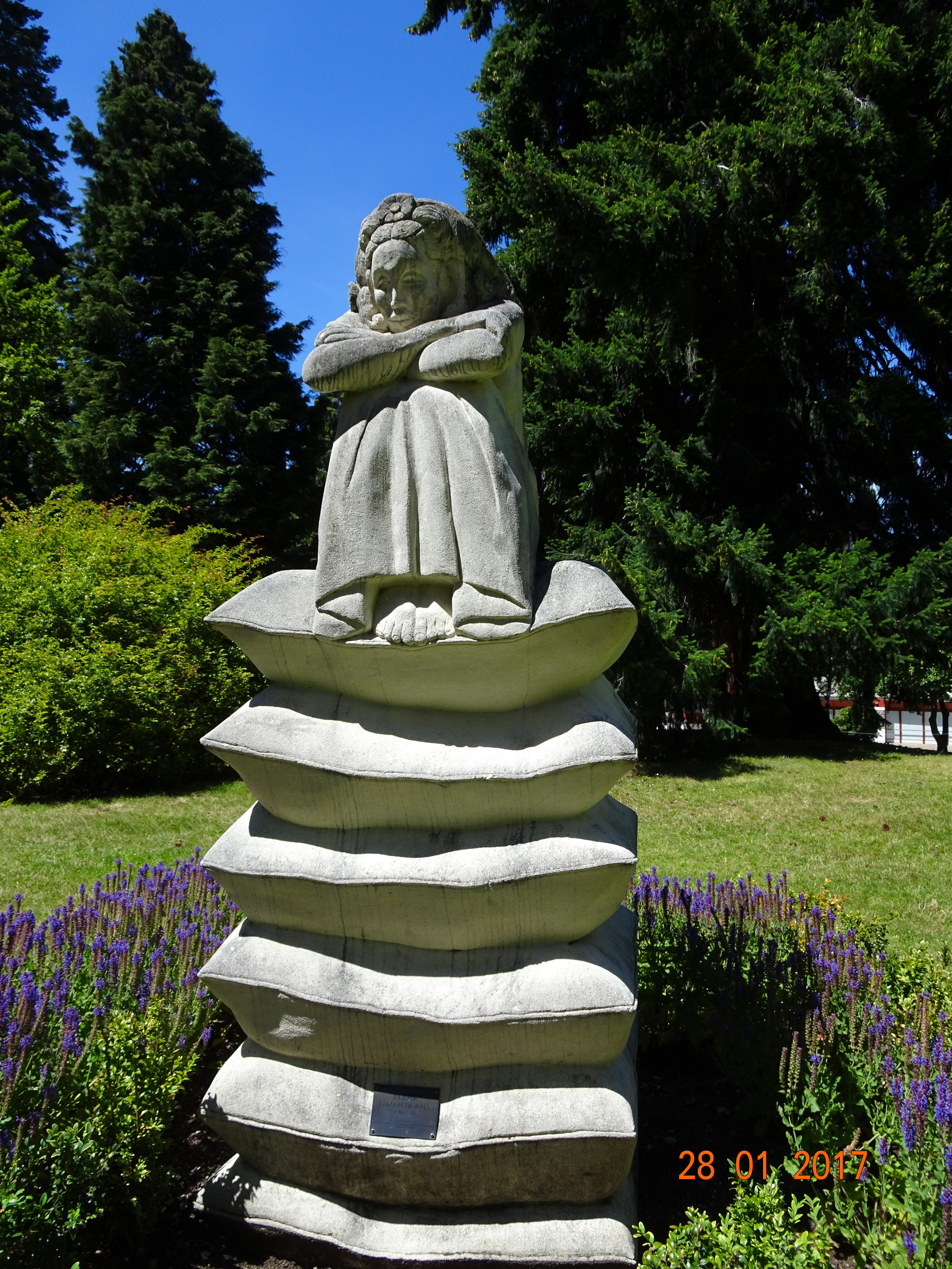
Once we’d got all the way round we cut back into the middle to see the rose gardens, watched some old men polishing their balls at the bowling green and came across some street theatre, Cinderella by the Remarkables Players.
“Fleur” in the flowers
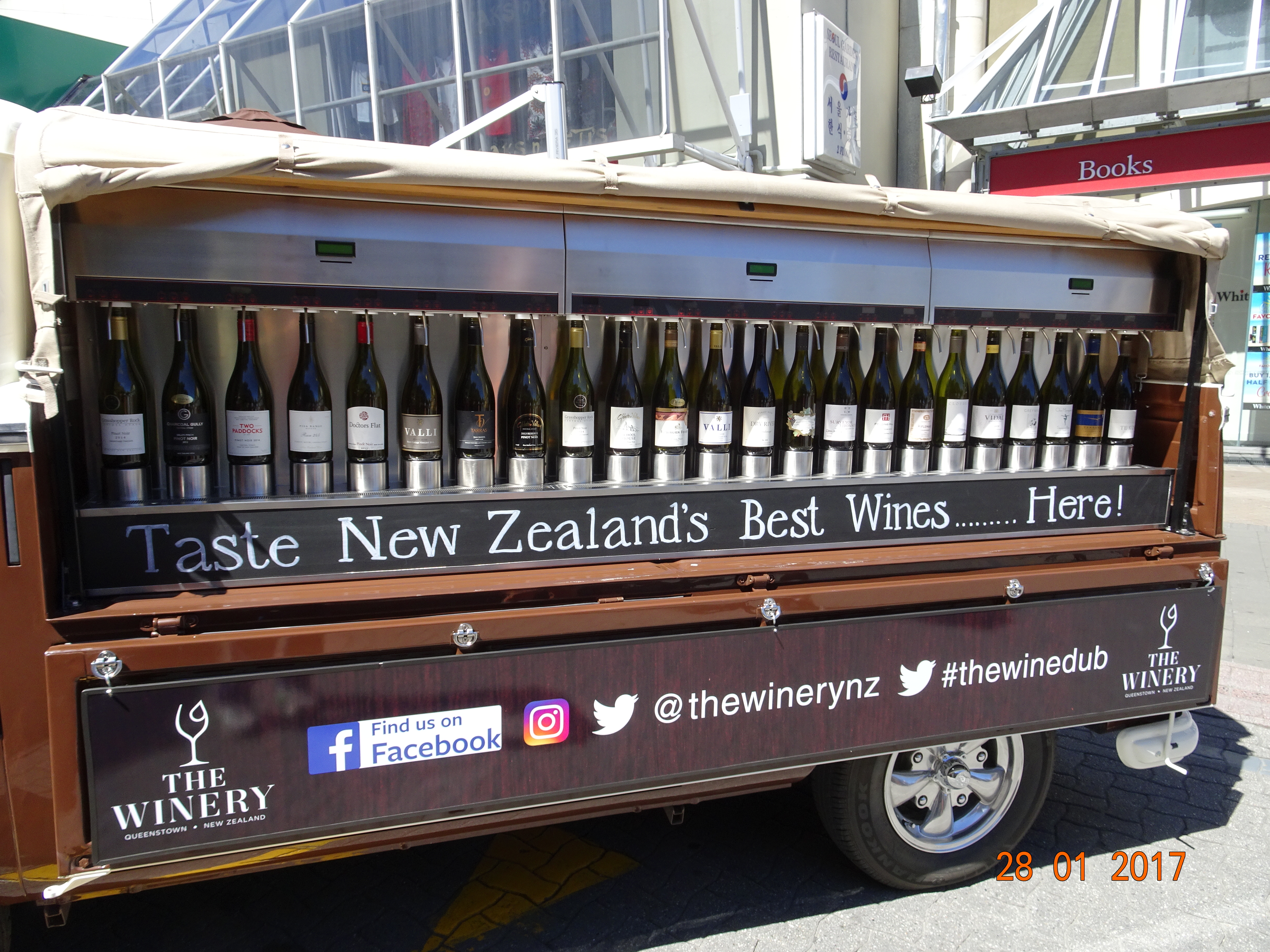
Back in town we came across an interesting initiative from NZ’s wine makers. It was an ancient VW campervan that had been converted for wine tasting, red on one side, white on the other. You stick your card in the slot, put your glass under a spout, press the button and then sit in the sunshine.
The following morning, we were going to take the scenic drive along the lakeside to Glenorchy, but it was persisting down with rain. In the end, we decided to have a day of rest instead; apart from a quick trip to the convenience store for a bag of crisps to go with our afternoon alcohol, we sat in the campsite and people watched.
Before leaving Invercargill we had to visit Pak n’Save to replenish our supplies. We couldn’t find the wine section so we – i.e. Diane – asked someone. Apparently Invercargill is the only city in NZ that doesn’t allow supermarkets to sell alcohol. You have to go to a bottle shop instead, of which there are many; they even have drive throughs, which seems to me to send the wrong message.
Anyway, with tears in our eyes, we set off for Te Anau without (much) alcohol.
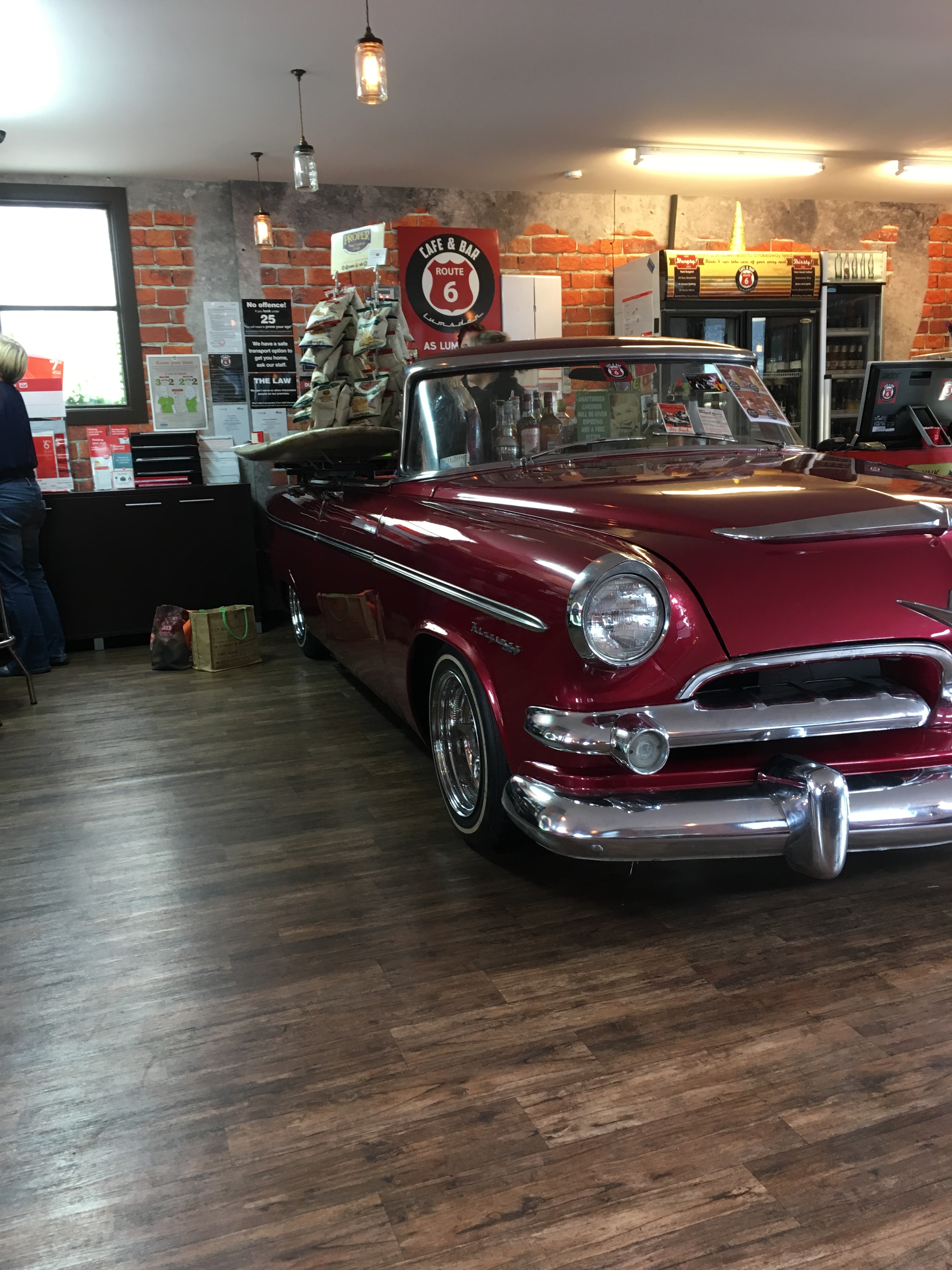
We stopped in Lumsden and decided to apply for this job vacancy at Route 6. I’m delighted to report that we were hired, although it was only a temp role. Route 6 turned out to be the local Post Office as well as a café; this has to be the best Post Office counter ever! And the bonnet was full of flat pack boxes and padded envelopes.
Post Office counter
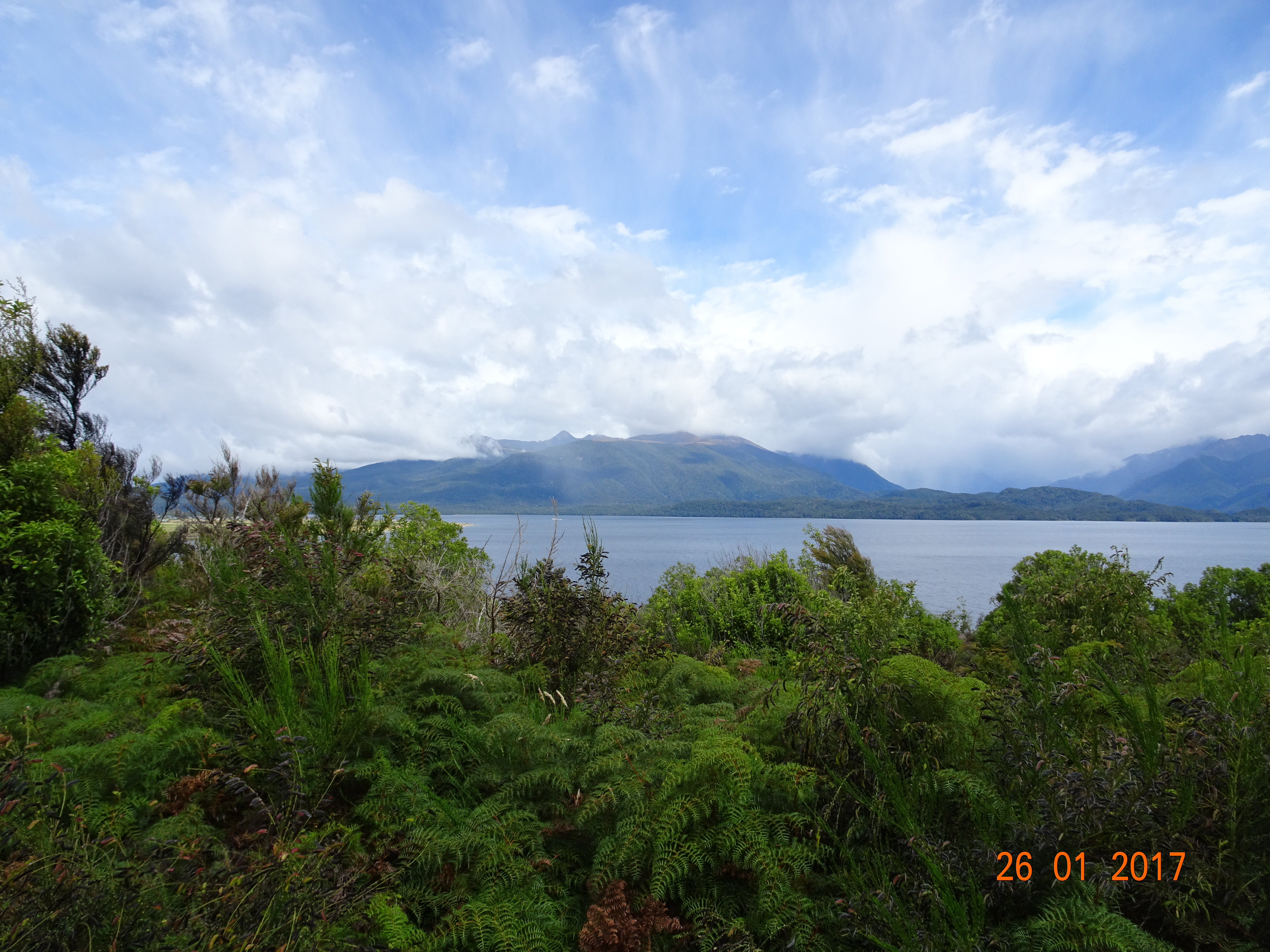
From here on there are always mountains in view and the road alternates between long, straight stretches and short, winding sections. When you get to Te Anau, this changes dramatically. We bypassed the town and suddenly found ourselves driving beside Lake Te Anau, with magnificent views of the lake. Te Anau is the largest lake in South Island and the deepest in NZ. Sitting high in Ermintrude we were able to see over the vegetation beside the road, but stopping places with a view were few and far between.
We’d planned to stop for the day at Knobs Flat, near the top of the lake. However, the satnav had taken us on the fast road rather than the scenic one so we decided to push on to Milford Sound.
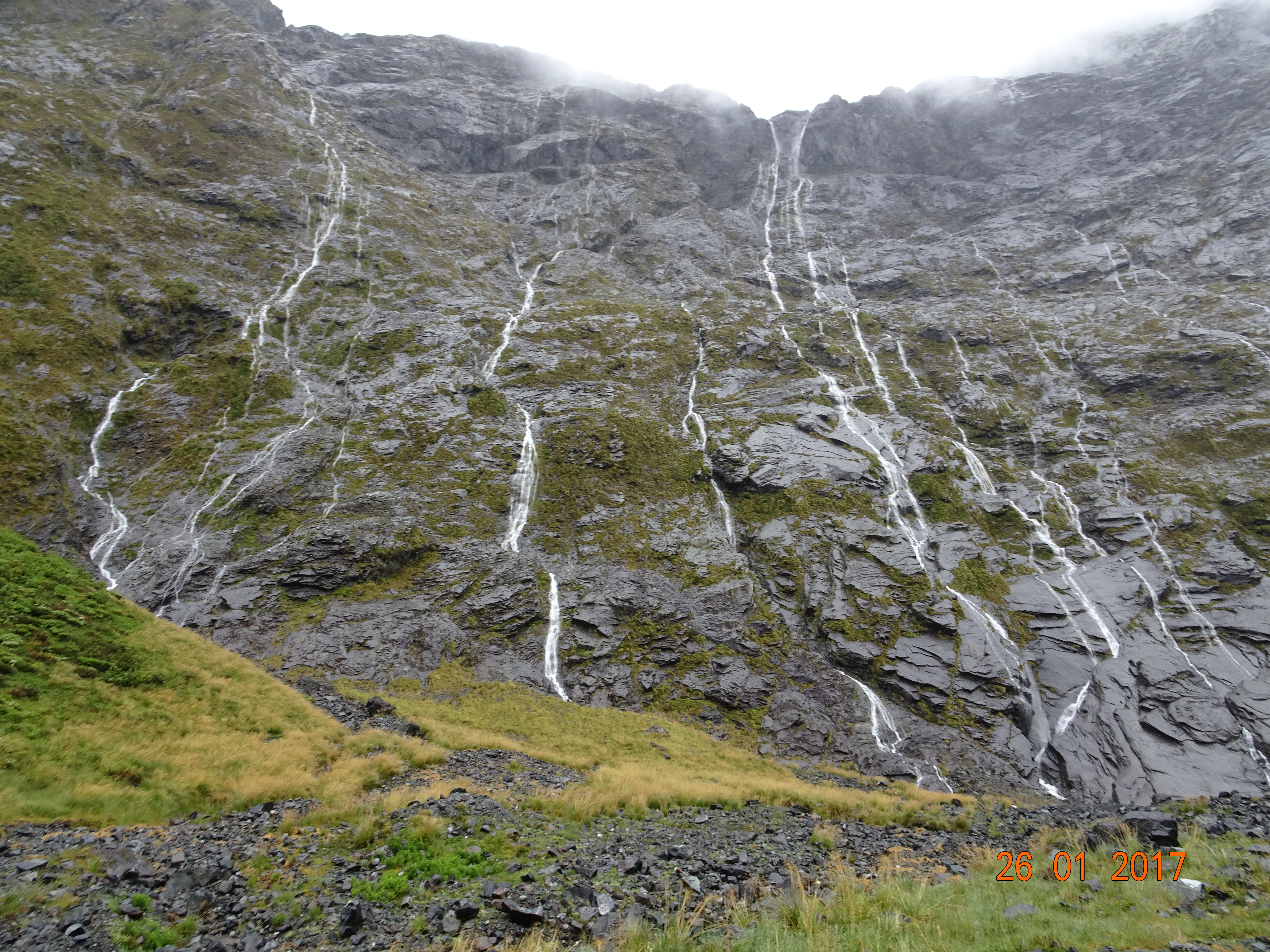
From Te Anau Downs to Milford Sound you have spectacular views coming at you from all directions. To start with it varies between wooded hills, open fields, bracken and gorse and the occasional archway of leaves formed by the woods on either side of the road. You’re climbing gently all the time and the view changes to dark, forbidding mountains with waterfalls streaming straight down them like veins.
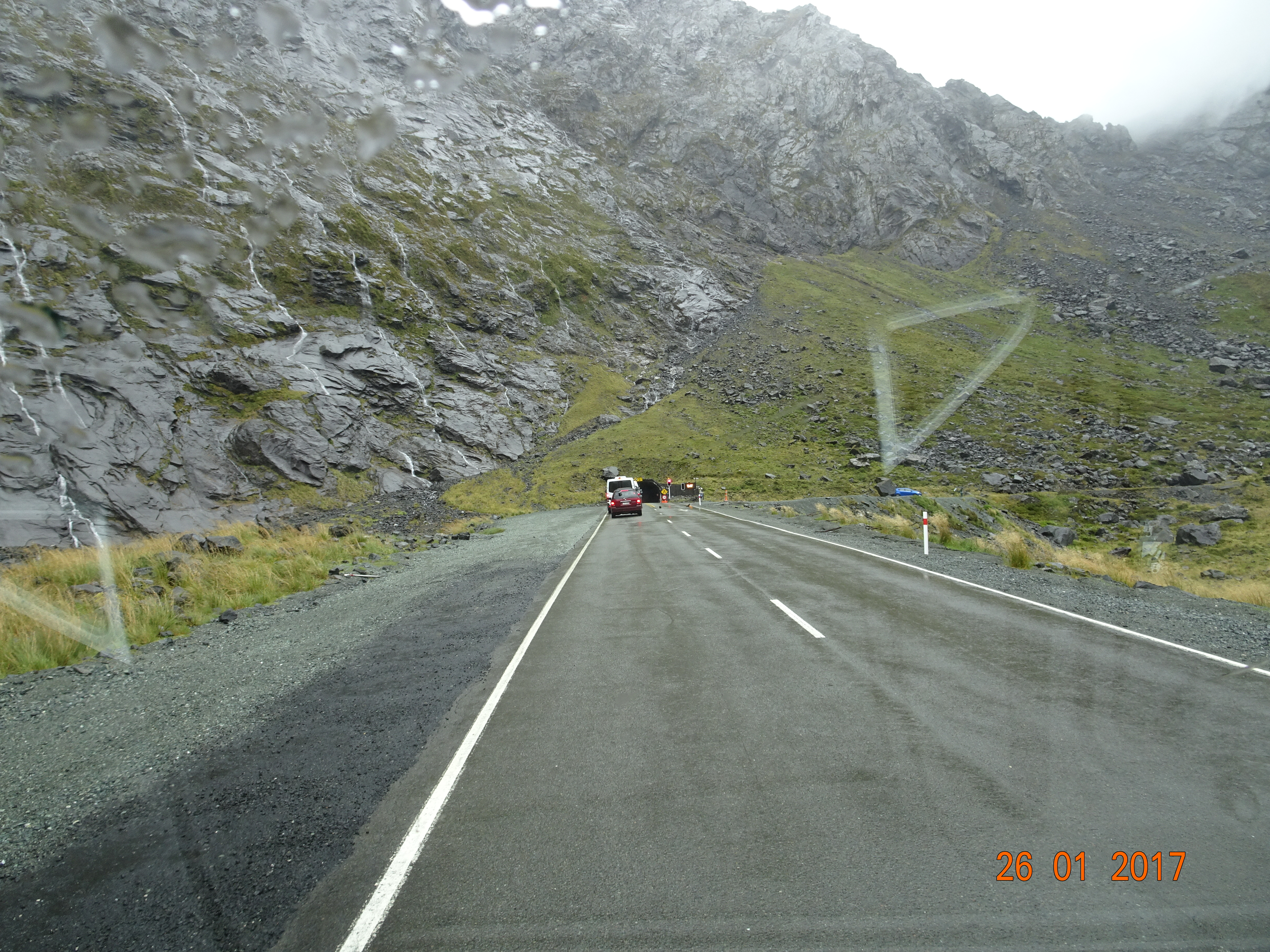
Then, in the middle of nowhere, you come to a warning sign for traffic lights! We’d arrived at Homer Tunnel, which is a single lane throughout its 1200m. The entrance is literally a hole in a vertical rock face and the tunnel itself is ragged and uneven, as if it was just blasted out and not finished.
From the moment you enter the tunnel you’re going downhill and it gets steeper after you exit at the other end, with plenty of hairpin bends, narrow stretches, rock fall areas and single track bridges. As it was raining continually by now and tour buses were coming thick and fast in the other direction, it made for an exciting drive!
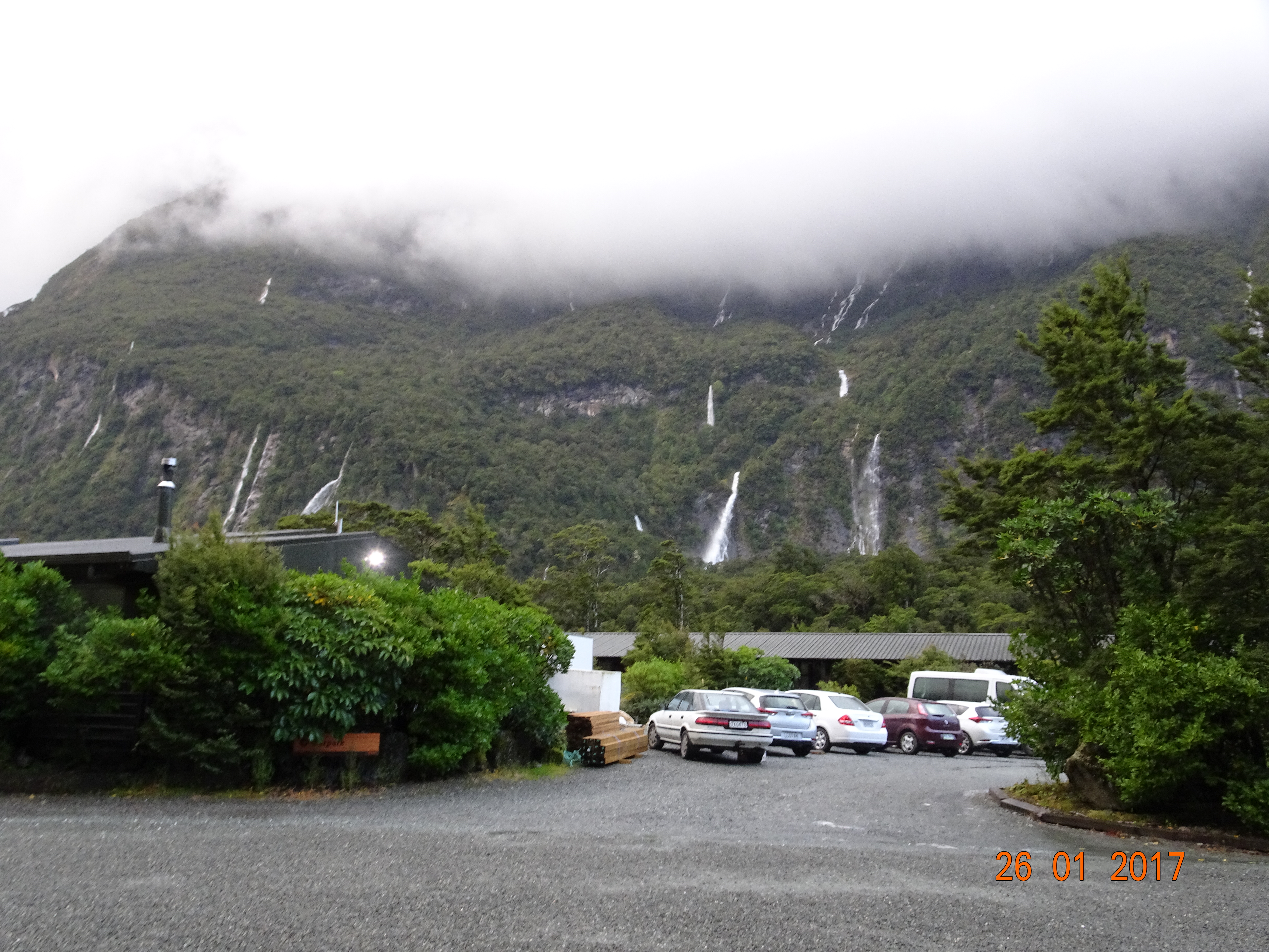
We didn’t quite make Milford Sound, as the only camp site in the area is just before you get there. It you want to get away from it all, this is the place to be. The mobile signal started fading as we drove alongside Te Anau, which meant the van lost the internet. There was no internet at the camp site and our dish couldn’t find a satellite signal. You could stay here and have no idea what’s happening in the rest of the world.
Our night at Milford Sound was hardly restful. Ermintrude swayed so much in the wind that our soap bottle fell off the shelf, and the rain came down in sheets all night.
Camp site car park
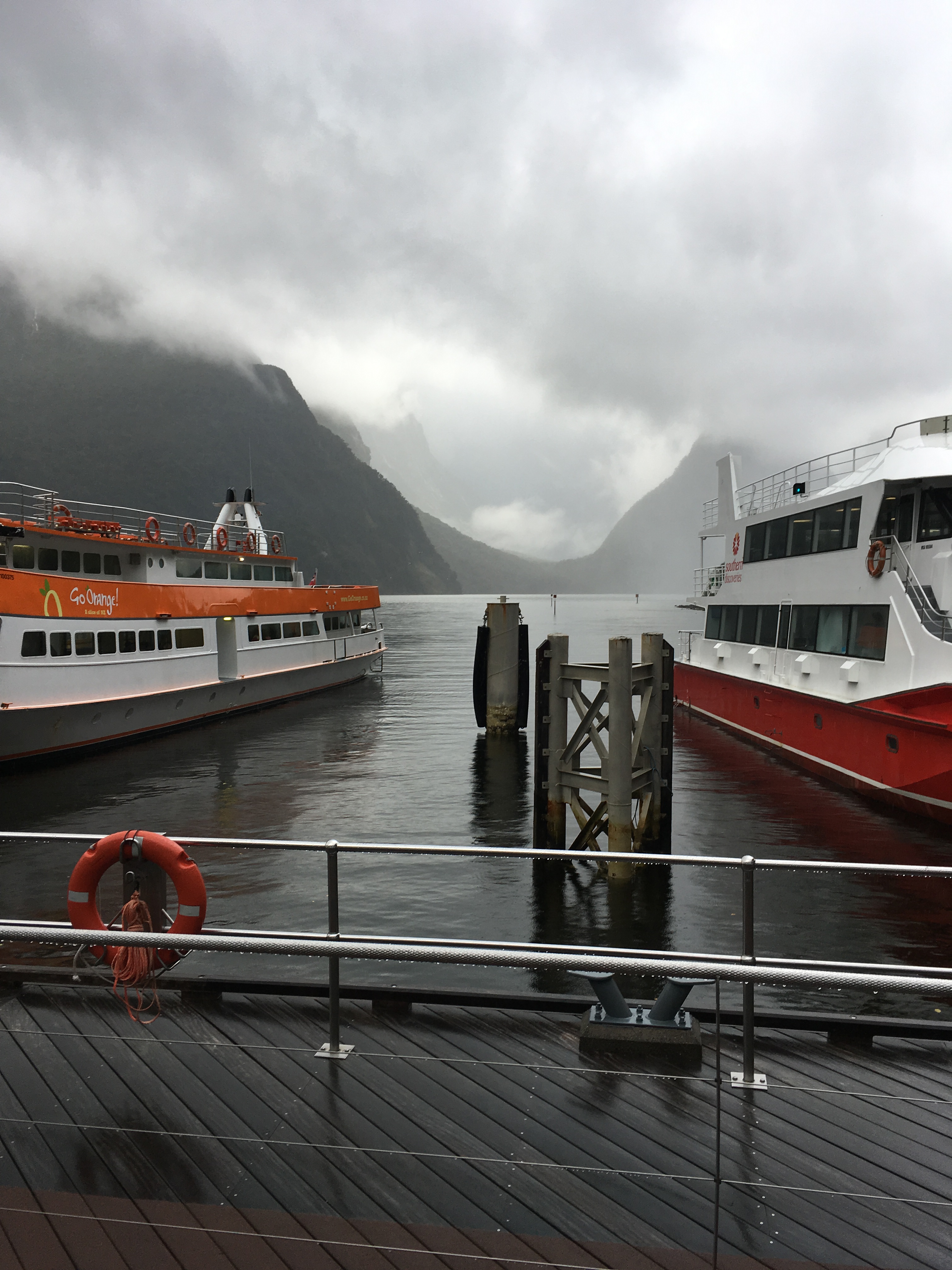
In the morning we went into Milford Sound itself and it appeared to be nothing more than a series of car parks, a bus park and a tour boat harbour. Of course, when you’ve got a hood over your head to keep the rain off, all you can see is the path in front of your feet, but I don’t think I missed anything. There wasn’t even a decent view of the Sound because of all the tour boats. What we did see was quite magnificent, but with the incessant rain and cloud tumbling down the mountainsides, we were glad we hadn’t booked a cruise.
Milford Sound
I read on an information board that Milford’s challenge was to remain unspoiled by its success as a tourist destination. Perhaps this would have been easier if they hadn’t built a bus park and tour boat harbour!
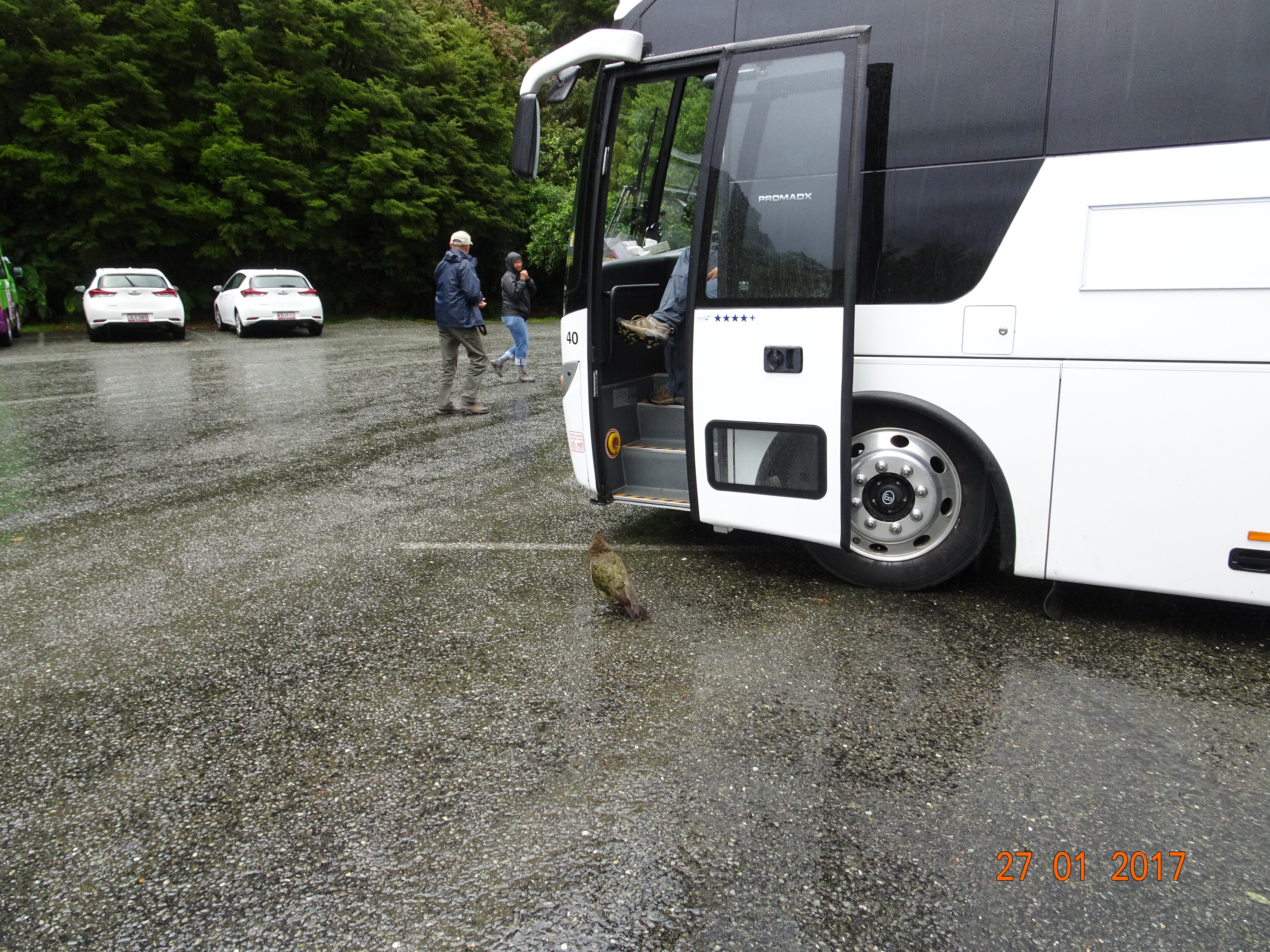
The only way out of Milford Sound – by road, at least – is back the way you came to Te Anau, so we set off. On the way down we stopped at The Chasm; there’s a 15 minute walk up some gravel tracks interspersed with wooden bridges and you come to a viewing platform above a waterfall on the Cleddau River. There are some fine examples of how stone can be eroded by flowing water. And I finally got a photo of a kea, although not a very good one – the photo, not the kea.
Kea’s there somewhere
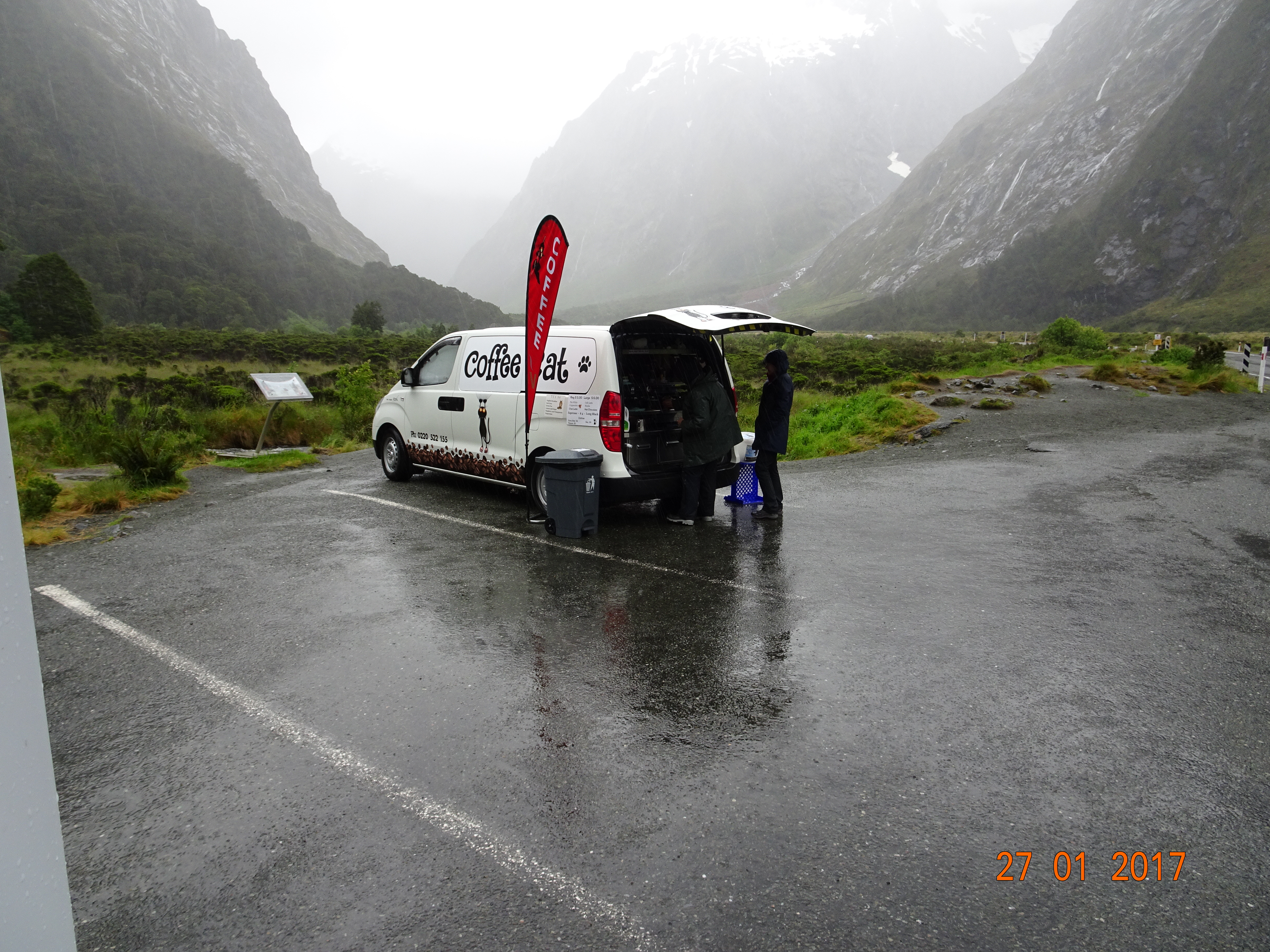
After passing back through Homer Tunnel, I was saying what a shame it was that we were two hours from the nearest coffee. Then we came across Coffee Cat with her mobile coffee van in a layby! Apparently she drives from south of Te Anau to there every day and sells coffee. Diane asked if it wasn’t a fairly lonely existence and she said she works with a colleague who usually stations herself at The Chasm; today was her day off. This is on the other side of the tunnel and there’s no mobile signal. Takes all sorts.
Coffee Cat
The coffee was very welcome and shortly after that the weather took a turn for the better too. We were going to stop at Mirror Lakes, but there were no less than seven tour buses parked there, as well as several cars, so we gave that a miss. In fact, our timing was impeccable because from there onwards, there was bus after bus heading towards Milford.
By the time we arrived at Te Anau the sun was shining. We checked in to a camp site and then discovered that the door to the living part of Ermintrude wouldn’t latch. I called the rental company and they said the retaining bar had probably moved. So I smacked it with a hammer; that improved it but it still wasn’t right and I didn’t want to risk breaking it. We drove down the road to a workshop at the local Caltex station and explained the problem. After cursing at the designer, the mechanic smacked the bar with a hammer. It did the job and away we went, with a warning not to hit it too hard as it will “break like a carrot”.
Parked back at the site, we set off to explore the town and then walked for a couple of km along the lake to the wildlife centre. Among other birds, they have two pairs of South Island kaka and several antipodes parakeets. We found a tub marked please feed the ducks so we did – and they then followed us around for a while as we looked at other enclosures!
Tomorrow is going to be sunny, and we’re off to Queenstown.
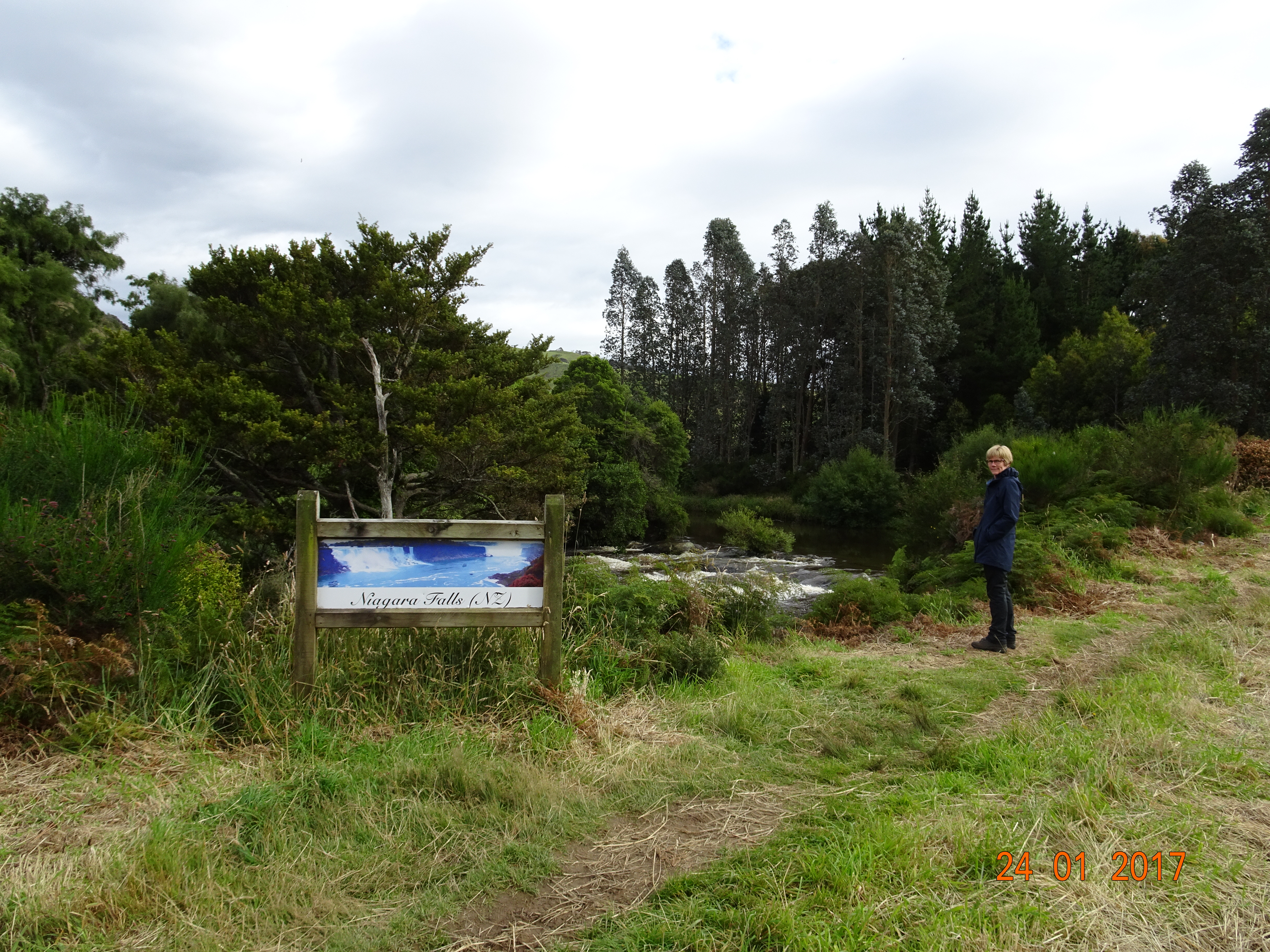
Leaving Invercargill on the Southern Scenic Route, we drove to Niagara Falls, apparently so named by a surveyor with a sense of humour! We parked up, donned hiking boots and jackets, then realised that the falls were just the other side of the road.
Niagra Falls
From there, we picked up the Catlins Coastal Heritage Trail, heading back to the west. We stopped off at Waikawa Bay, a former whaling station and port, with yet another museum.
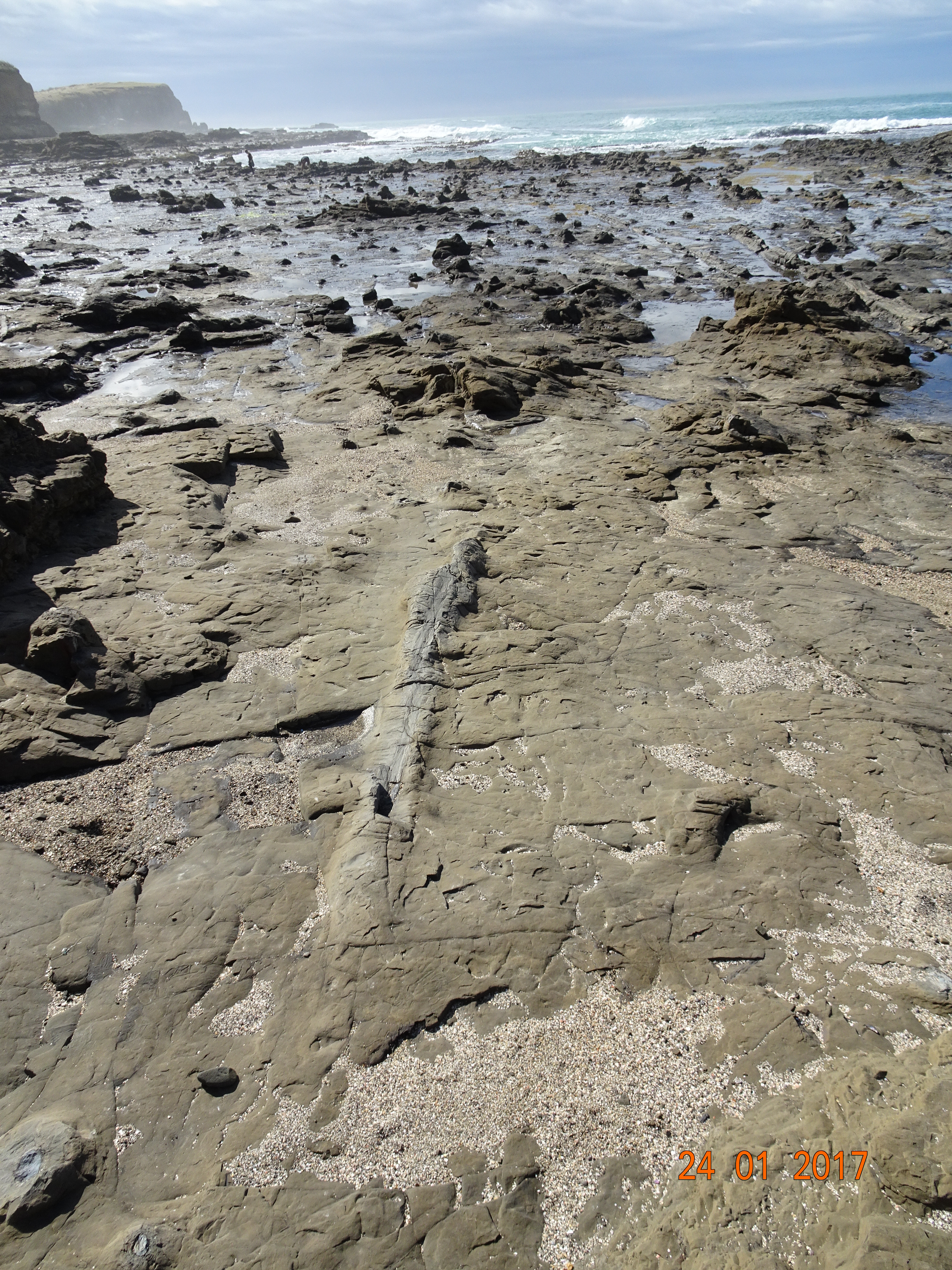
Next we arrived at Curio Bay, luckily at low tide, as this is the site of the petrified forest, dating back to the Jurassic period. This was formed when an erupting volcano showered the area with volcanic debris and impregnated the trees with silica, effectively turning them to rock, and it stretches from here to Slope Point, 20km away. You can quite clearly see the shape of the logs and woodgrain in the stone.
We then walked across to Porpoise Bay, home to Hector’s dolphins, one of the world’s rarest. They are so rare that we didn’t see any, nor the yellow-eyed penguins or sea lions that live here. We did find some lime and strawberry milk shakes, though.
Porpoise Bay
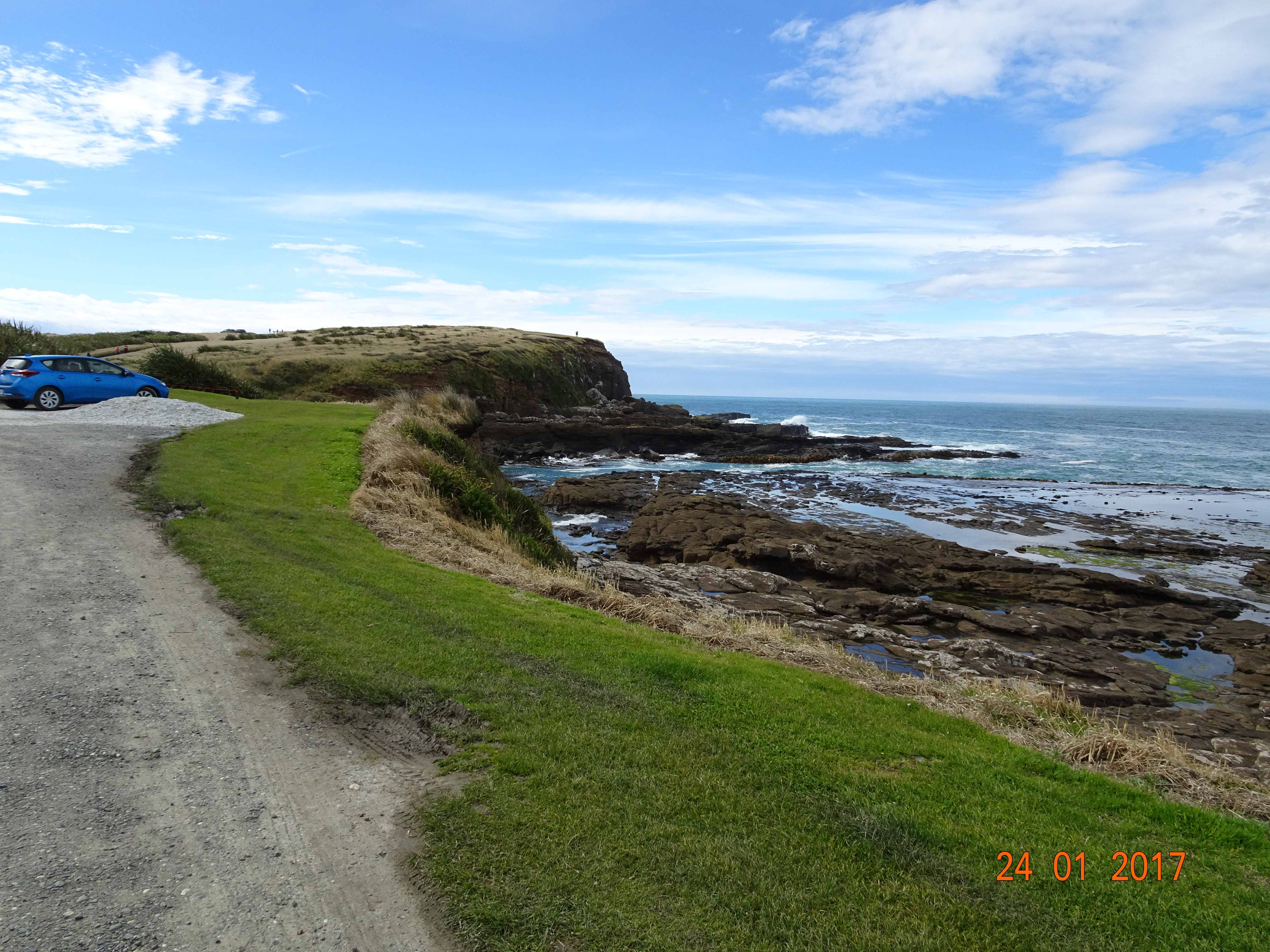
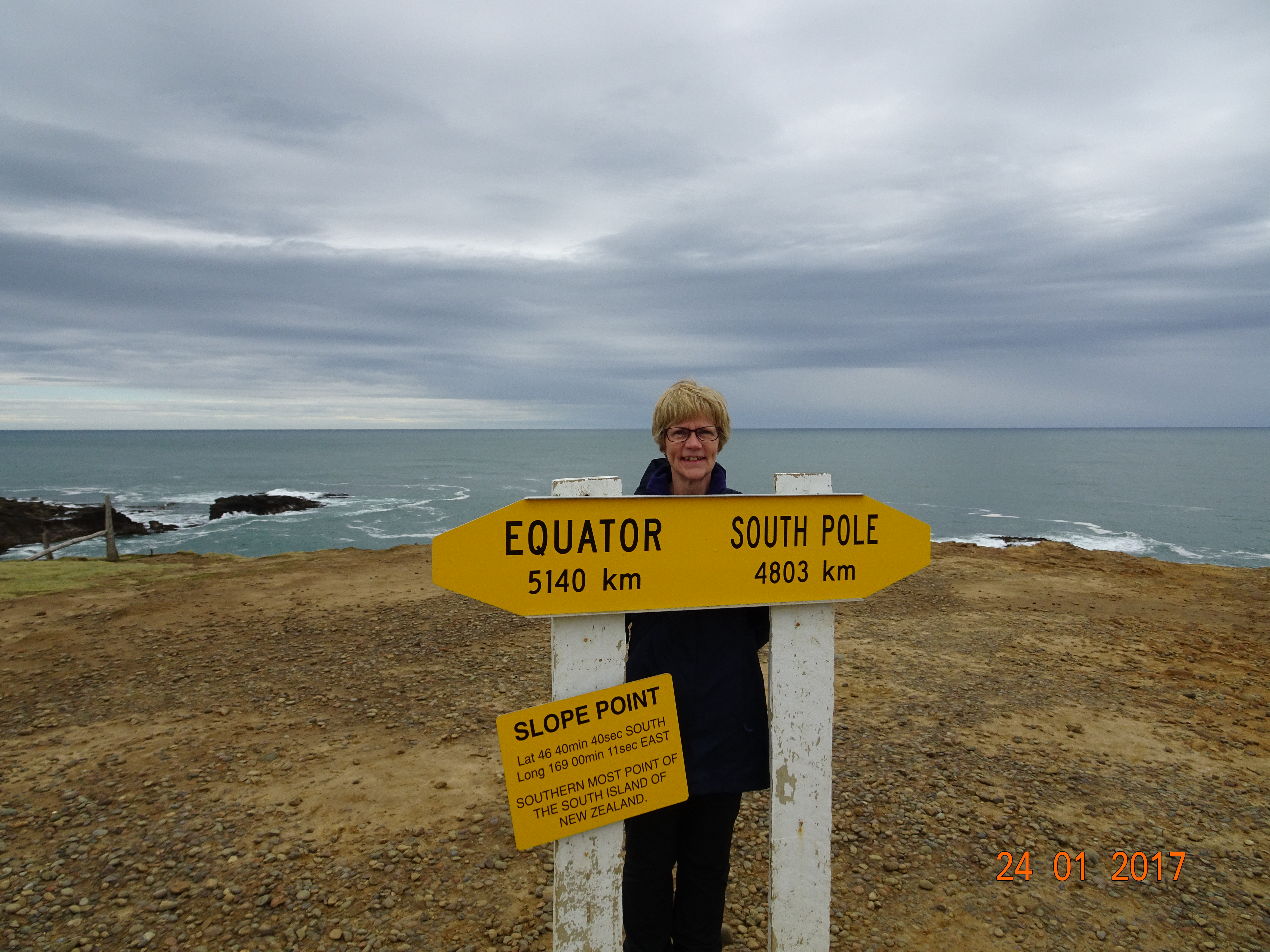
After that, it was time for another gravel road. We drove to Slope Point, the southernmost point on South Island. From the parking area it is about a well-trodden 20-minute walk down to the point itself. For a few minutes we were the southernmost people in South Island!
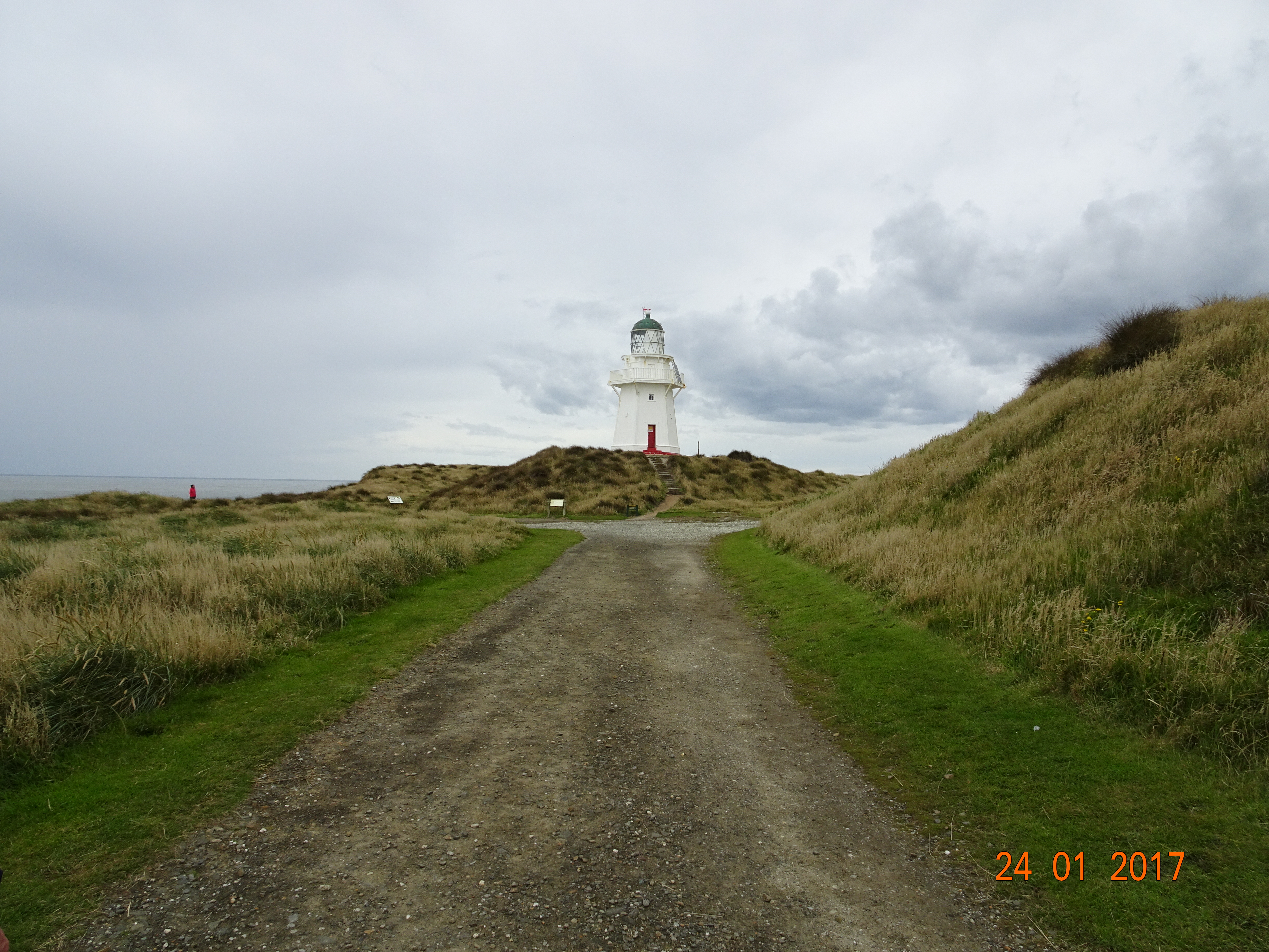
The gravel road then led us to Waipapa Point, scene of the worst maritime disaster in NZ, where the SS Tararua sank in 1881 with the loss of 131 lives. After the disaster, they built a lighthouse there, the last wooden one built in NZ, with the actual light room being manufactured in Scotland. We did finally get to see some sea lions – on the beach about 100 yards away!
Waipapa lighthouse
In case you’re wondering how I know all these facts – there are excellent information boards all along the Heritage Trail, full of stuff about the flora and fauna at each site.
We returned to the Scenic Route and made our way to Bluff, the southernmost town on South Island. We’d planned to stop overnight here, but the place was quite dreary and the campsite very expensive, so we decided to return to Invercargill instead, via an excellent restaurant, the Thai Thai in Tay Street.
We’ve been bombed again today! The wind has been howling all night, with 60kph predicted this afternoon, and we keep getting torrential showers. The forecast for all the places we’re planning to visit over the next week is more of the same for the next five days, so we’ve decided to stay put and get all our cleaning and washing done. Tomorrow we’re off to fiordland.
In fact it rained all night and it was still raining in the morning. We didn’t feel like walking along the beach in the rain, so we decided to head for Gore instead. The only bright spot of the day was when we stopped off at a 4Square and they gave us a scratch card; Diane won a beach bag!
Despite the rain, we really liked the campsite in Gore and would probably have stayed an extra night if it hadn’t still been raining. It was in walking distance from the town centre, with big pitches well separated from each other. The facilities looked like they’d been installed in the 1950’s by someone using the Reader’s Digest DIY Manual, but they were clean and functional.
We chose Gore because there were several indoor things to see – but by the morning the rain had stopped! We visited the Gore Historical Museum – which looked like the pickings from several house clearances – and the Eastern Southland Gallery before driving north to Mandeville. This is the home of the Croydon Aviation Heritage Centre, which houses the largest collection of de Havilland aircraft in the southern hemisphere. A lot of these aircraft are still in service, and they do offer flights. Fortunately, it was too windy for them to fly today.
Tiger Moth with a scale replica
From there we made our way to Invercargill, the southernmost and westernmost city in NZ. Once again, our campsite was in the city centre, and as the sun managed an appearance we set off to explore. One of our best finds this afternoon was a real fishmongers; we dined on baked King salmon this evening. It’s still very windy, and Ermintrude is swaying like the cross channel ferry, but tomorrow we hope to be able to get to the tip of South Island.
We went to take the bus into town again today, only to discover that they only run one per hour on a Saturday. Rather than wait another 35 minutes, we decided to walk the 3.5km into the centre. On the way, we were struck by how faded Dunedin looks. While there are lots of grand buildings, most of them have seen better days. The first km of George Street we walked along was all hotels and properties for sale or rent, with the next section being all bars and restaurants until you get right into the centre. Even worse – we saw a Starbucks!
We’d spotted an organic coffee shop yesterday so stopped off for a coffee and cookie before heading for the art gallery. I was particularly taken with an exhibition by Kushana Bush, a local artist. In the permanent section, there was an odd mixture of styles, with a Gainsborough and a Monet surrounded by modern, experimental pieces.
Leaving there, we set out to walk the Street Art Trail, 25 pieces painted by street artists from around the world. On the way we diverted into the railway station and then the Otago Settlers Museum. Finally, we returned to the organic coffee shop for a Love Bowl, a delicious soup with soba noodles, crunchy veggies and tofu.
Double-ended steam locomotive
The bus back to the campsite was going to be another 30 minutes, so we again resorted to Shanks’s pony and walked back; the bus overtook us about 5 minutes from the site.
Our neighbours!
Tomorrow we’re off into some of the more remote parts on the Southern coastline.


 I’m delighted to report that we were hired, although it was only a temp role. Route 6 turned out to be the local Post Office as well as a café; this has to be the best Post Office counter ever! And the bonnet was full of flat pack boxes and padded envelopes.