With all the weather warnings and thunderstorms, we decided to spend another day at Hamilton. It was a nice, cheap site, and there was a track leading down to a stream that we could use in the intervals between the downpours. And when it rained, it really did. There was no warning, it just tipped it down.
Fortunately, there were only three or four other people staying there so we had almost exclusive use of the TV lounge and kitchen. On the first evening we got chatting with another couple who live close to our next destination. They’d just bought their motorhome in the south and were travelling home but stopped because they couldn’t face doing another couple of hours in the rain.
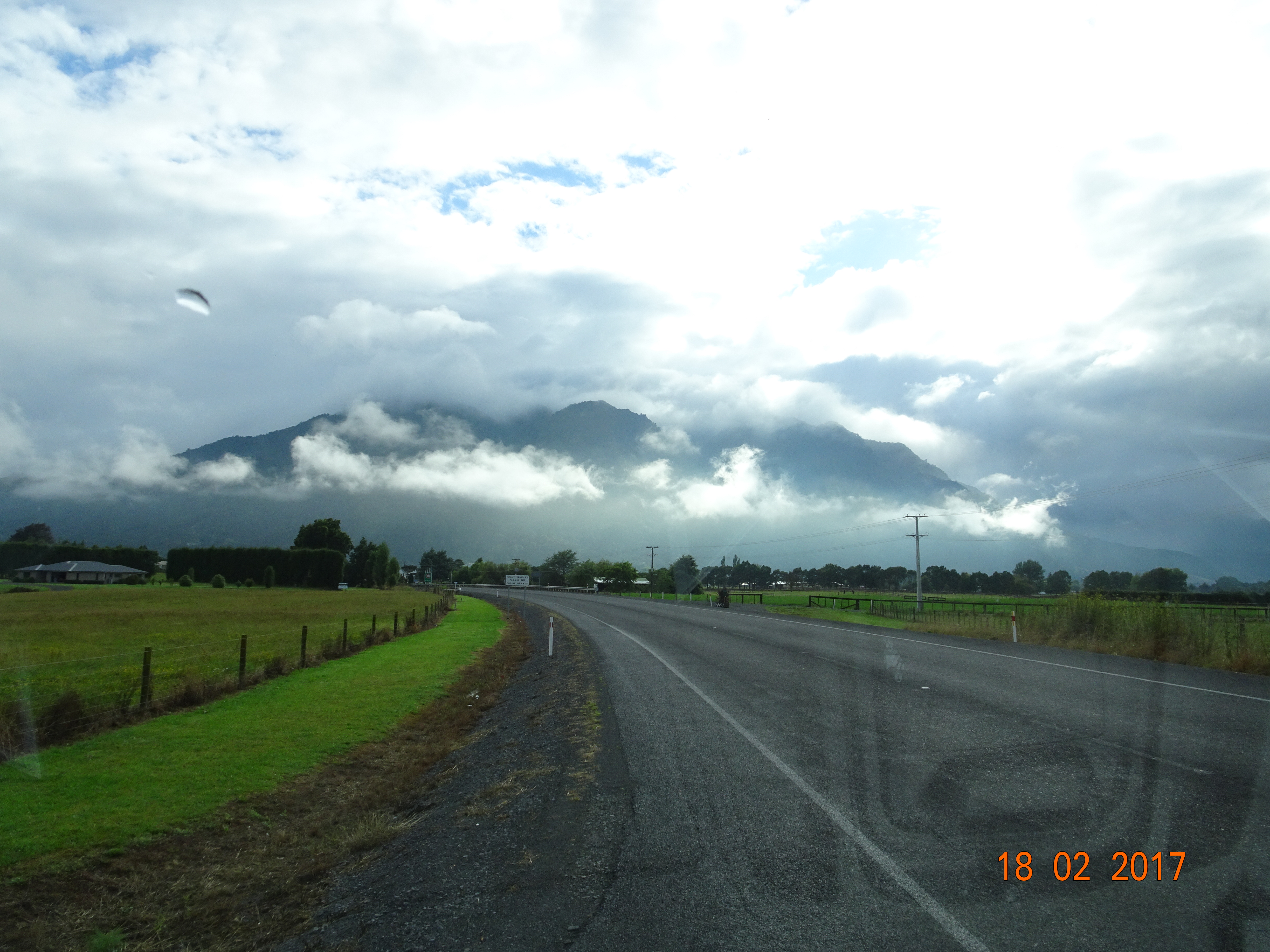
Then we hit the road again, heading west on SH26. We were driving on a fairly open plain to start with, apparently a dairy farming region as we went past a couple of dairy processing plants. Just as we were remarking that we hadn’t seen any mountains, this one loomed up out of the mists!
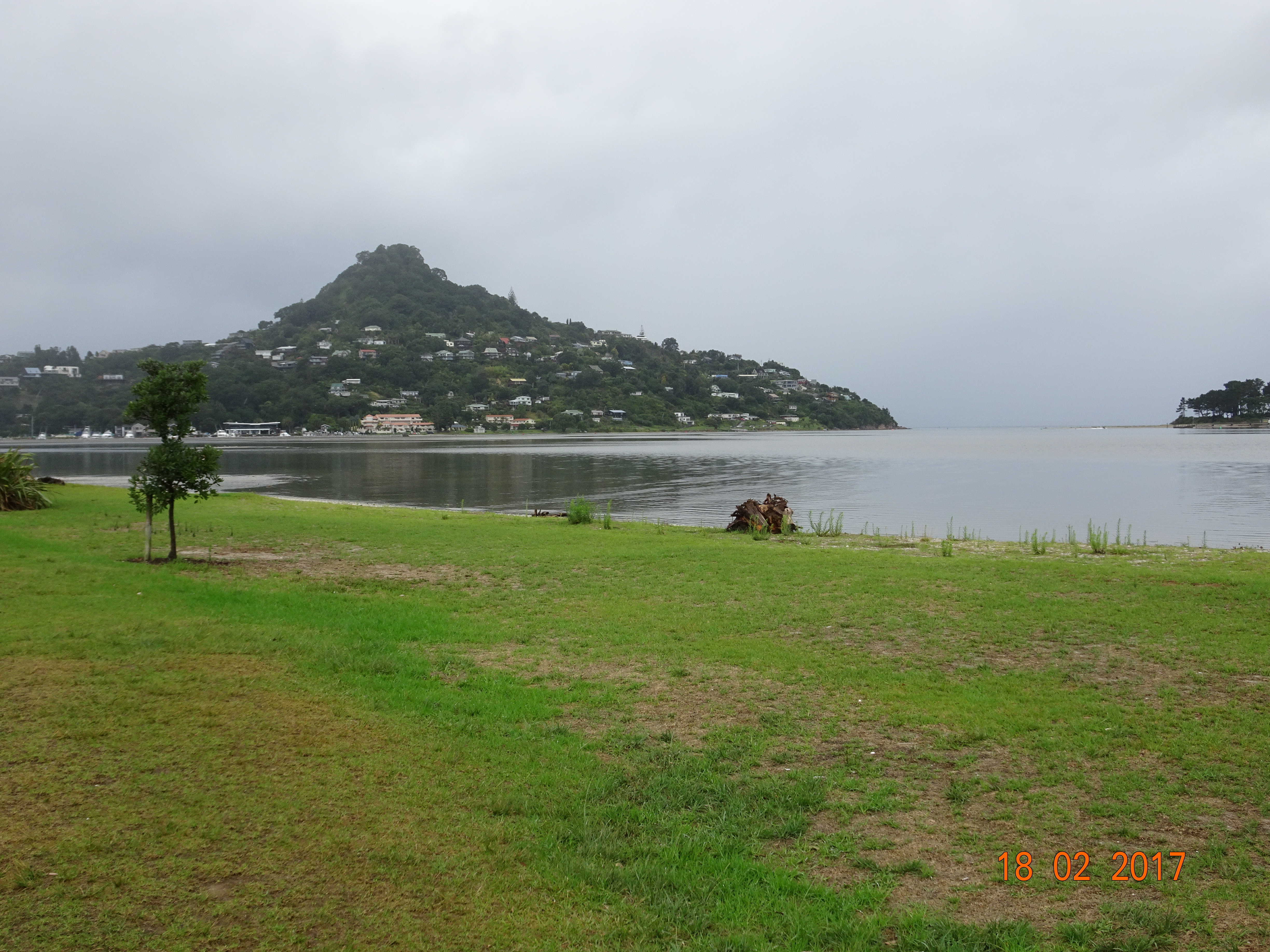
This was at Te Aroha, where we turned north to Paeroa and then took the Karangahake Gorge road to Waihi. Unfortunately we don’t have any photos of this due to the rain and lack of stopping places. At Waihi we met up with an old friend – the Pacific Coast Highway – which we followed to today’s destination, the harbour town of Tairua.
As a change from driving north, we set off in the morning on SH5 towards the south.
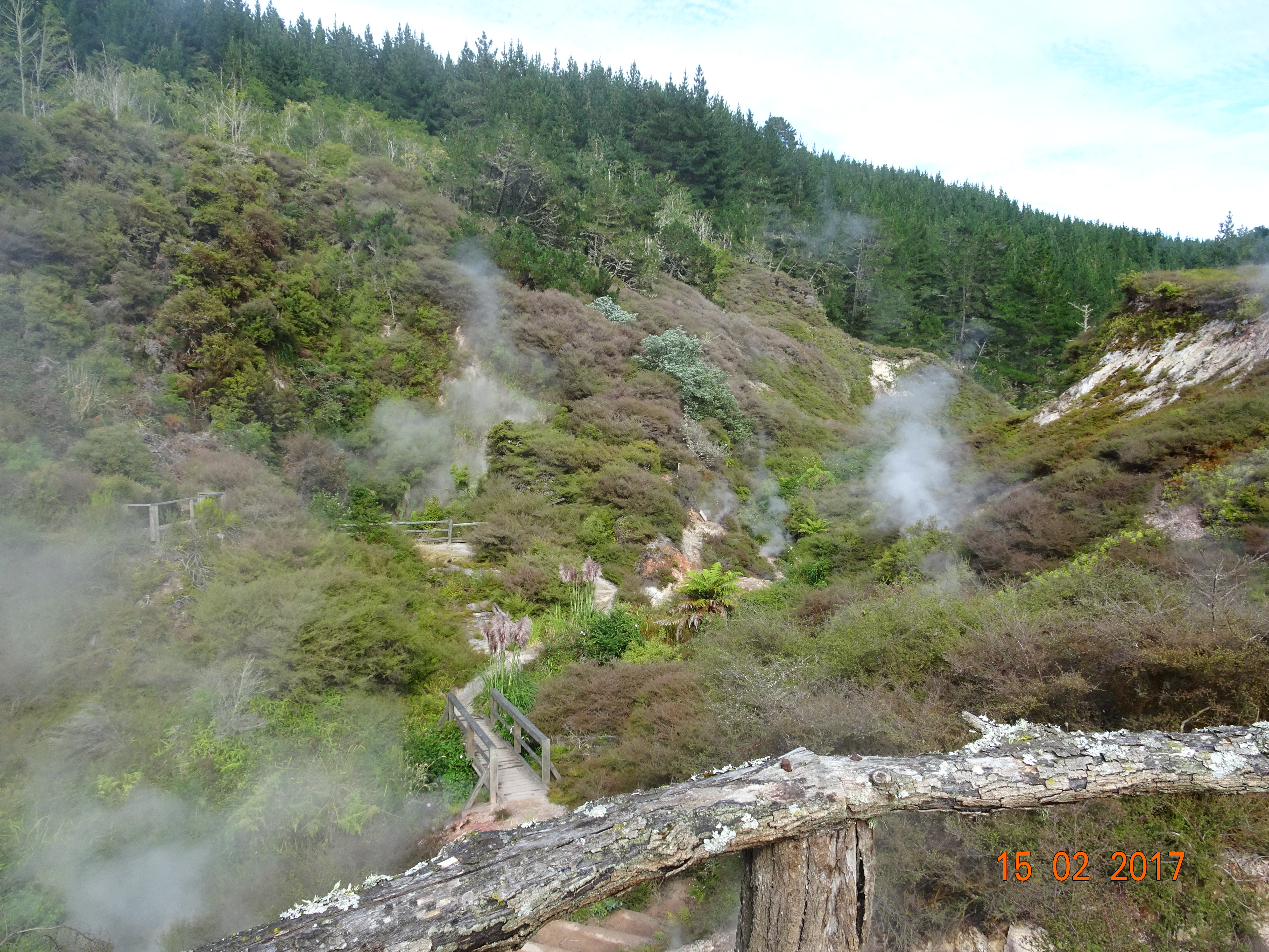
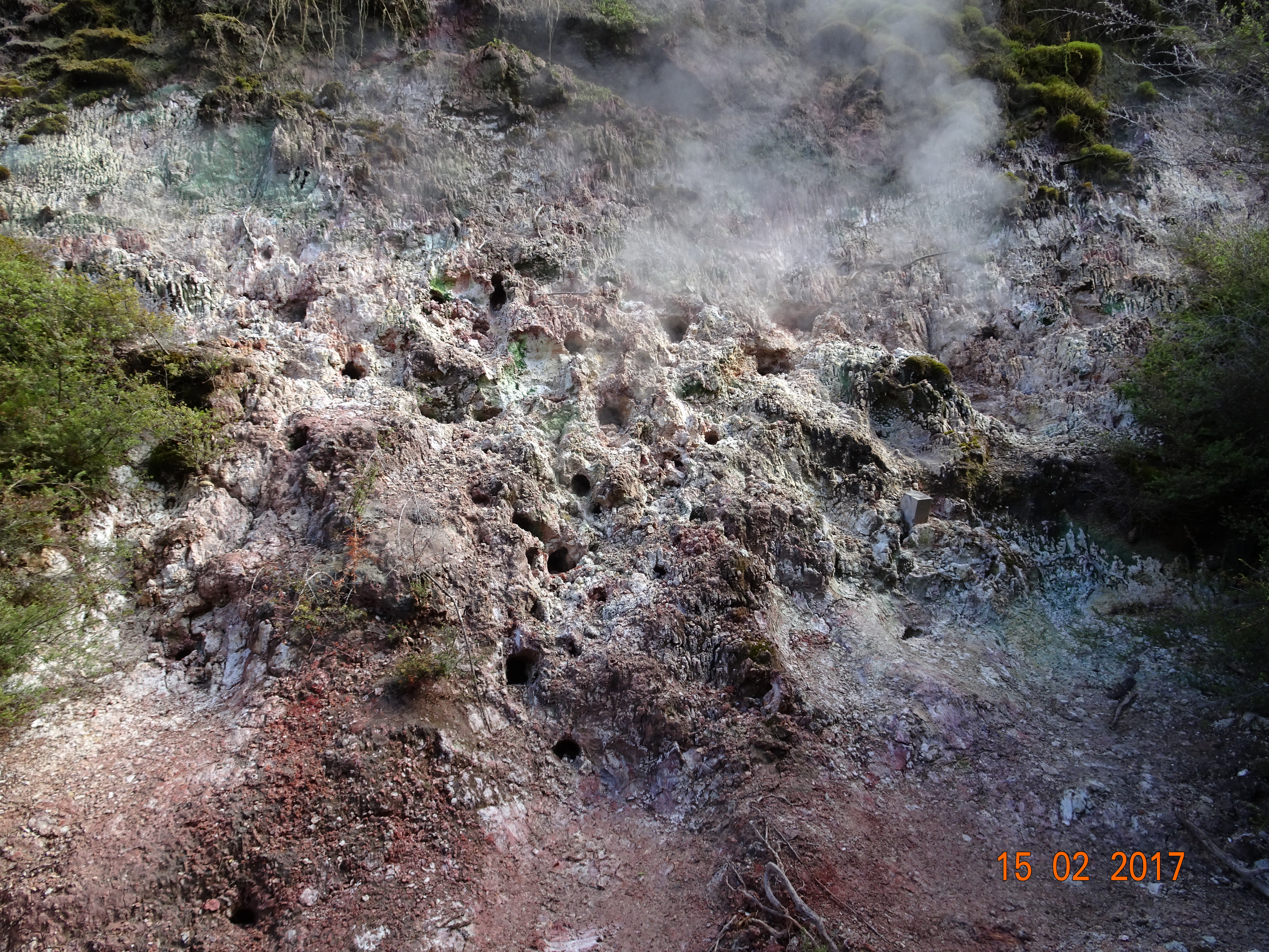
This whole area is a hot-spot (see what I done there) of geothermal activity – which basically means that you see columns of steam coming out of the ground at random places and everywhere smells! Driving along SH5, at one point we couldn’t decide if we were driving through fog, low cloud or steam.
Our first stop of the morning was for a circular walk in Wairakei Natural Thermal Valley, an active geothermal area. Armed with a map and a “laser thermometer” (so we could find the temperature of the rock without burning our hands), we left the café through the back door and found ourselves in an enchanted valley with a stream and steam. There are some wooden bridges along the way, but most of it is natural and the ground actually feels quite spongy.
They’ve named various features; among other things, we saw the witch’s cauldron, the devil’s throat and the dragon’s mouth. We also followed a sign to the singing cliff; we didn’t see him, but we did find a wall that whistles and hisses!
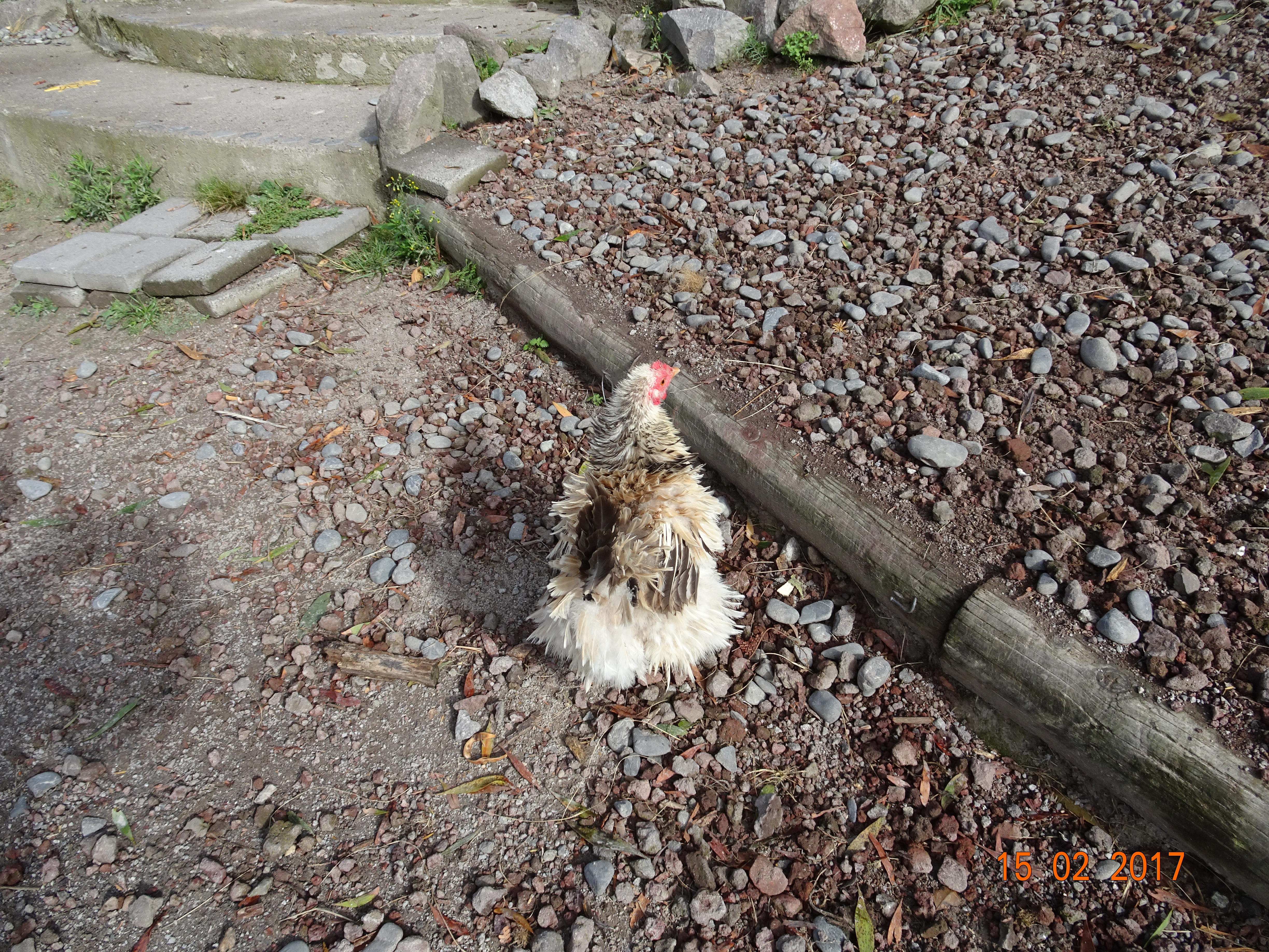
The owner also keeps a variety of birds and animals in the grounds, including an untidy chicken, llamas and peacocks.
An untidy chicken
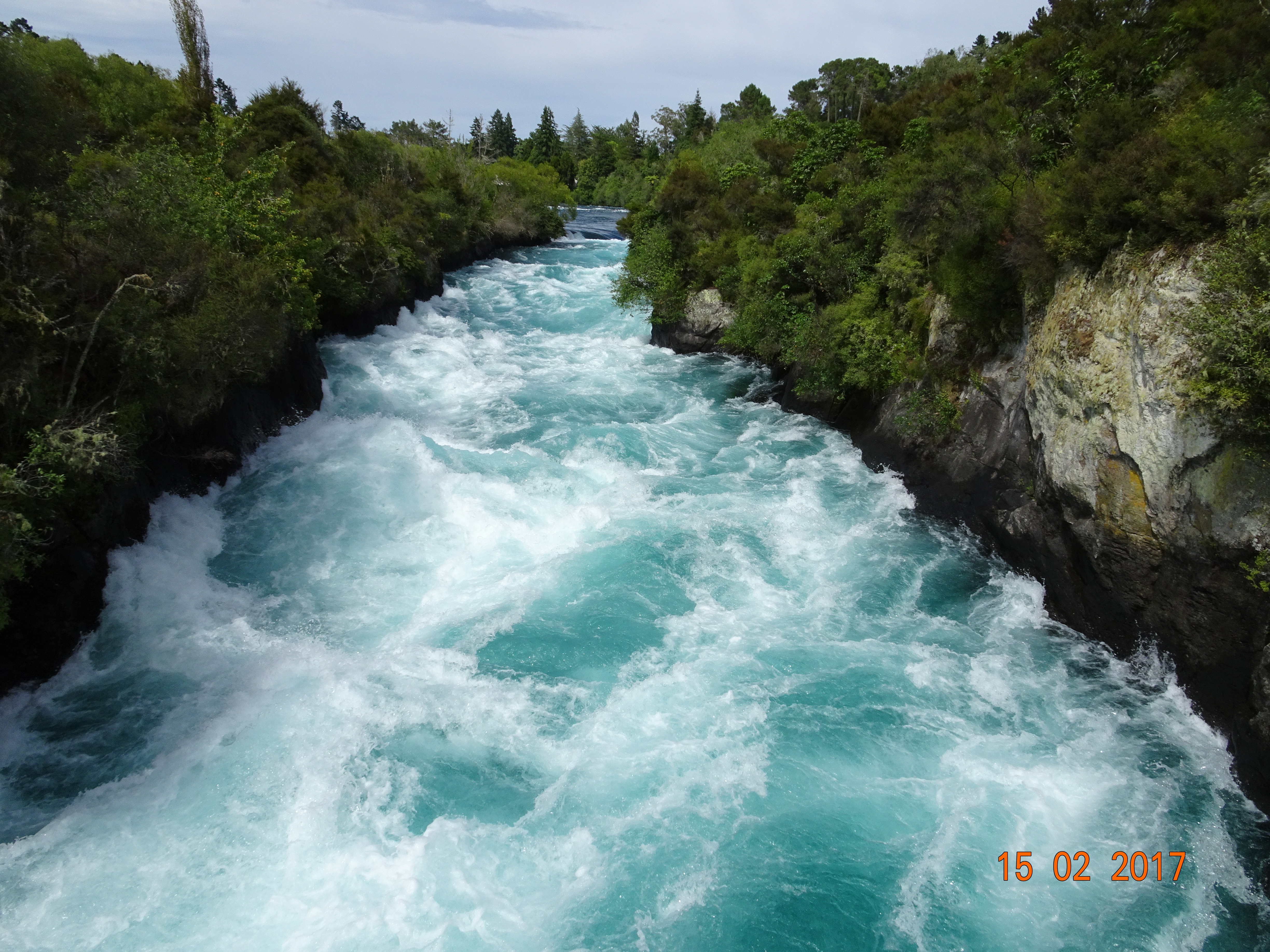
A little further down the road, we came to Huka Falls, where the Waikato River narrows from 100 metres wide to 15 metres. This makes for a very noisy and powerful set of rapids. You can view them close up from a boat or at a distance from a helicopter. We chose to walk over the bridge!
Huka Falls
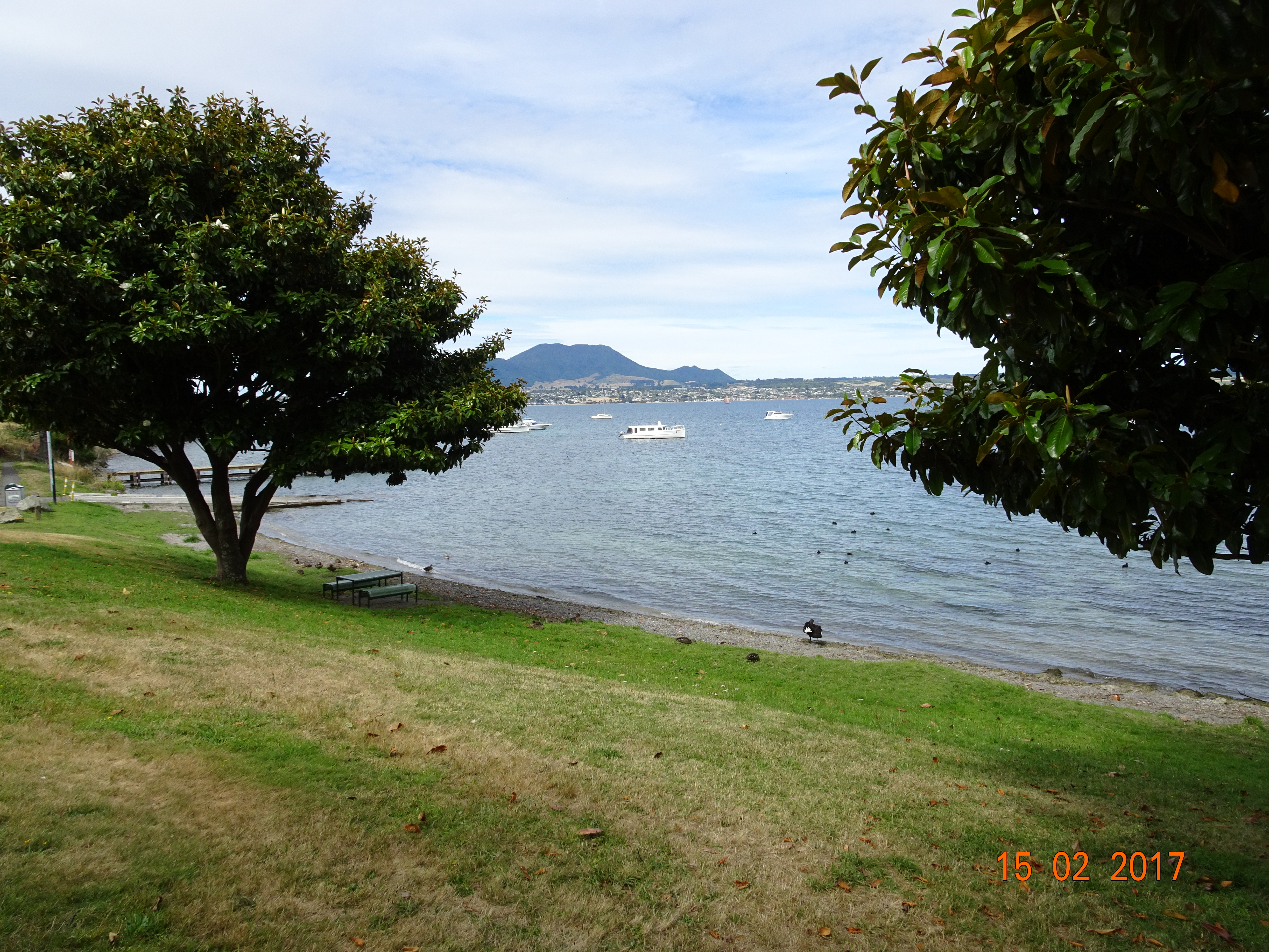
The water in the Waikato River comes from Lake Taupo, NZ’s largest lake, and that was our next destination. We checked in to the Great Lake Taupo Holiday Park and then set off to walk the 2km to the delightfully named Acacia Bay. From where we could get down to the lake itself to admire the view and enjoy our ice creams.
Lake Taupo
This morning we were back on SH1 heading north again for Hamilton, NZ’s fourth largest city. The approach to the city is very green, with trees and parks lining the road. The centre, while the roads are quite wide, is very busy and parking for a motorhome is limited. As it was raining heavily again, we paid a quick visit to Hamilton Gardens and then headed for our camp site to wait out the weather.
In the morning, we walked the 1km into town to have a look round. The centre of Rotorua is all shops, but many of them look quite tired. Further towards the lake, they liven up a bit, with one street housing restaurants of all nationalities. The lake itself is huge and there were hundreds of birds either sleeping on the water or begging tourists for food.
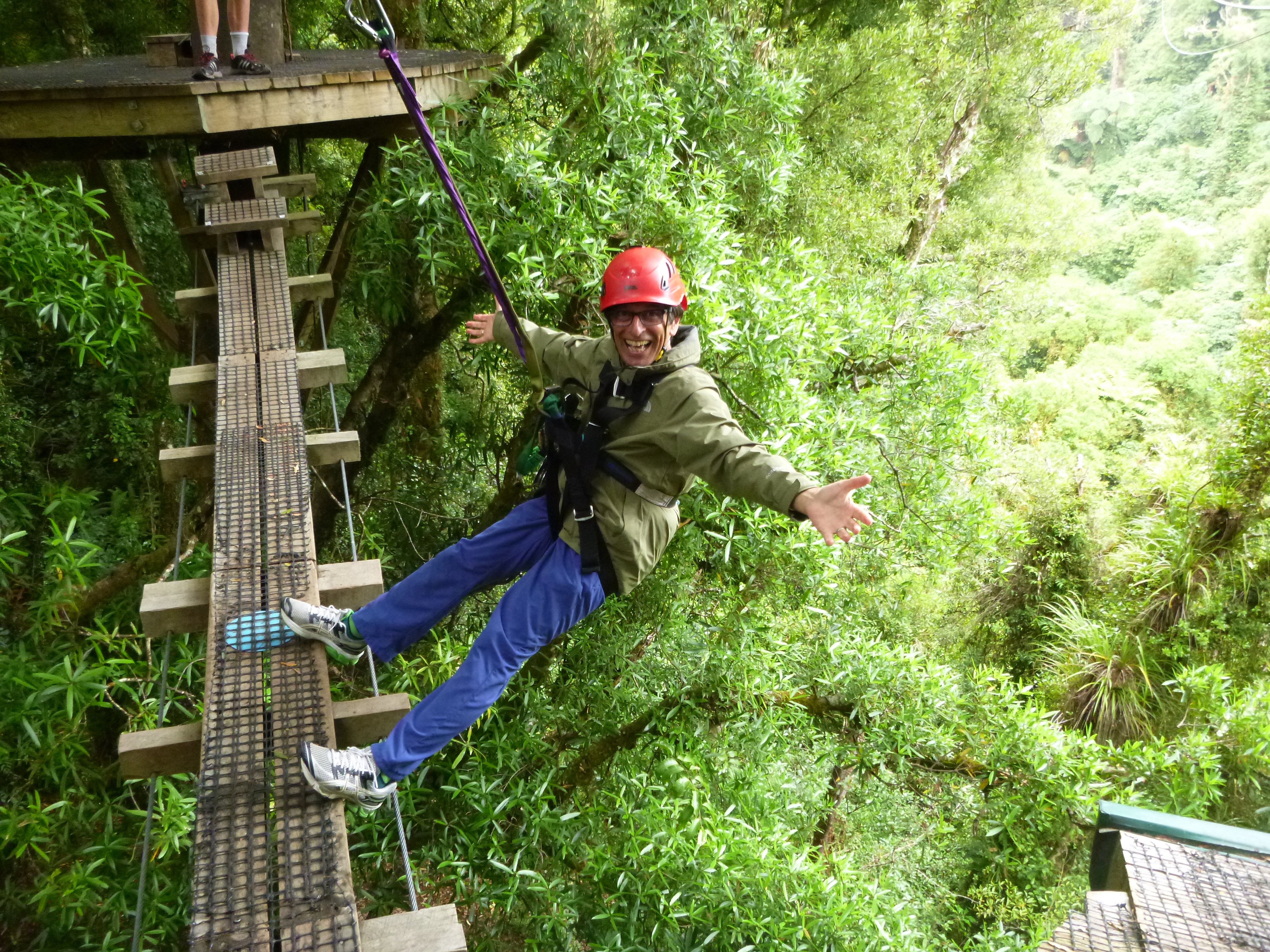
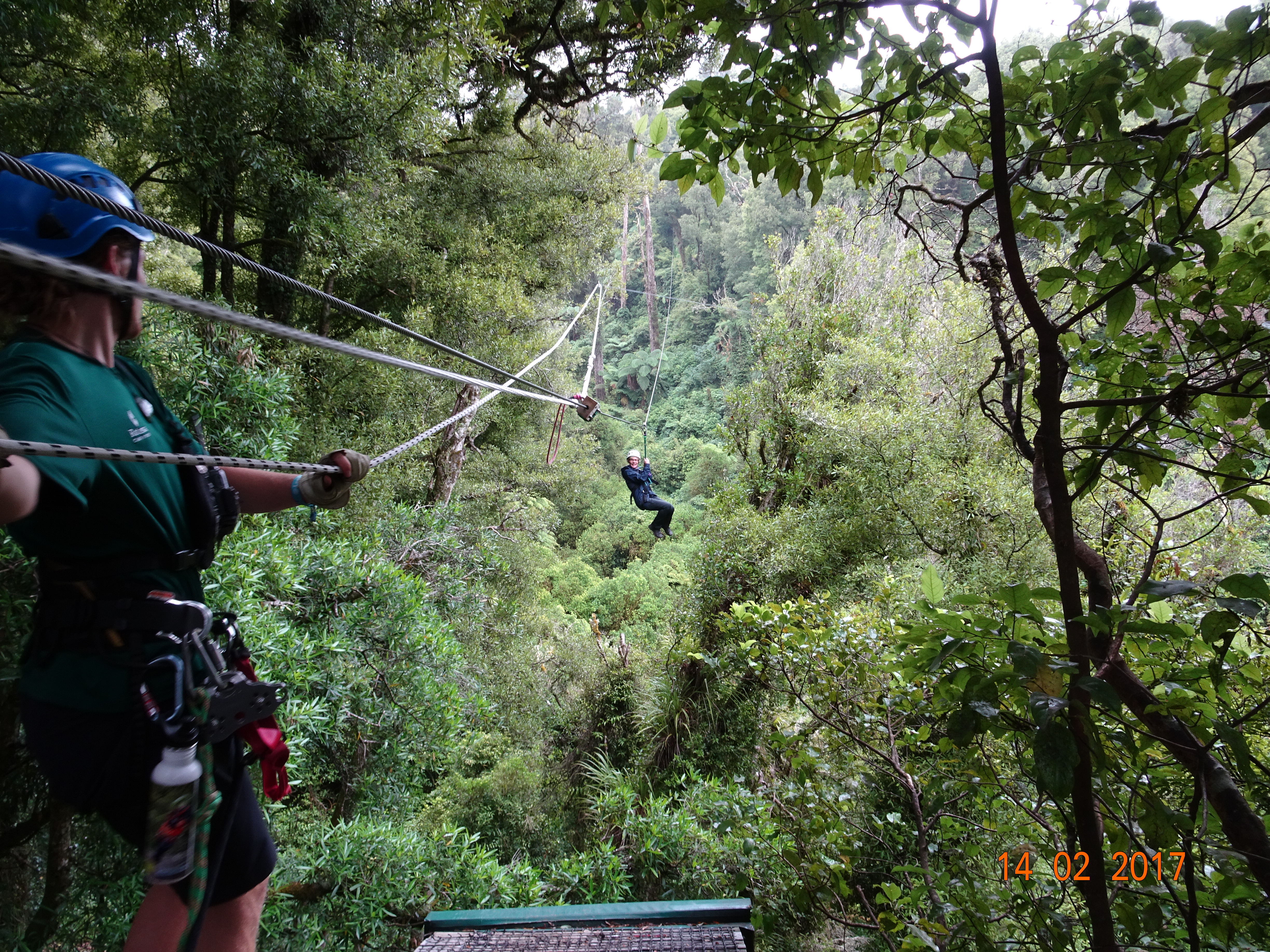
We then returned to the site for a quick bite of lunch before being picked up to be taken to our rainforest canopy tour. Billed as a 3-hour eco adventure, it is set in 500 hectares of native rainforest within a conservation area. When the group took on the land, it had been over-run by possums, rats and stoats which had “killed almost every bird in the forest and decimated the eco-system”. Over the last three years the Canopy Conservation Trust has trapped thousands of these pests, to the point where native birds are now returning to the forest.
And they’ve funded part of this work with the Canopy Tour, which is part adventure and part educational. At the office, ten of us were fitted up with our harnesses and safety gear, then bundled into a van for the trip to the start. Our two – very well-rehearsed – guides kept us occupied by having us introduce ourselves.
Once in the forest, you are immediately struck by the light; it has to filter through the canopy of leaves overhead, so everything has a green tinge. It’s a bit like being in a church with stained glass windows. The guides introduced us to a number of plant species, including the silver fern, which is the logo of several NZ organisations.
Then we took a narrow track through the trees and up loads of steps. Eventually we came to a platform where we had a safety briefing. Basically, don’t touch anything metal, bend your knees and grab the rope if the guide tells you to. At that point, the first guide attached himself to a cable, opened a gate in the railings and sailed across to another platform in a tree 70 metres away. Naturally, we all followed suit!
This was the first of six zip lines, which, along with two rope bridges and a conservation trail, formed our circular tour. An exhilarating experience!
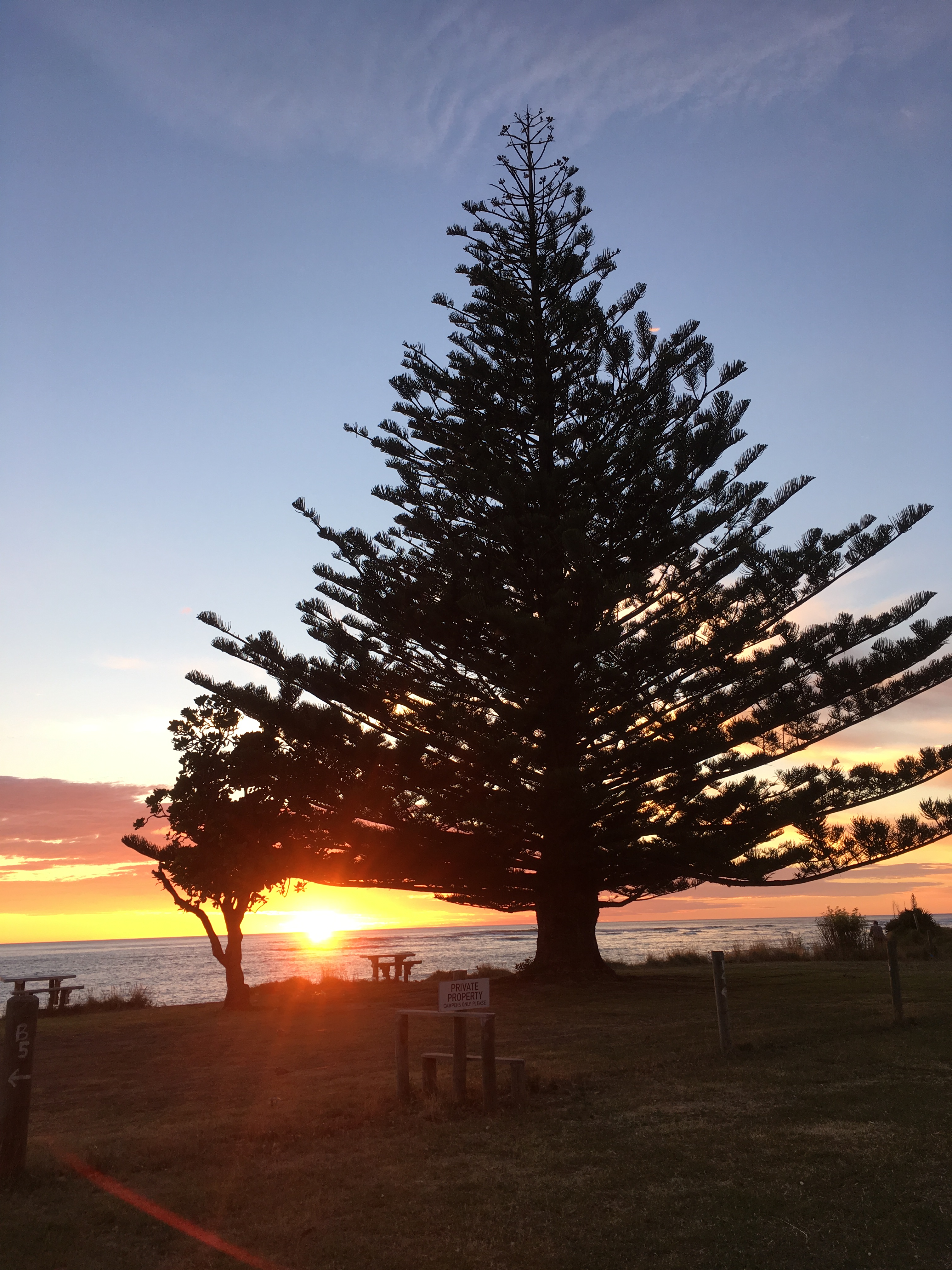
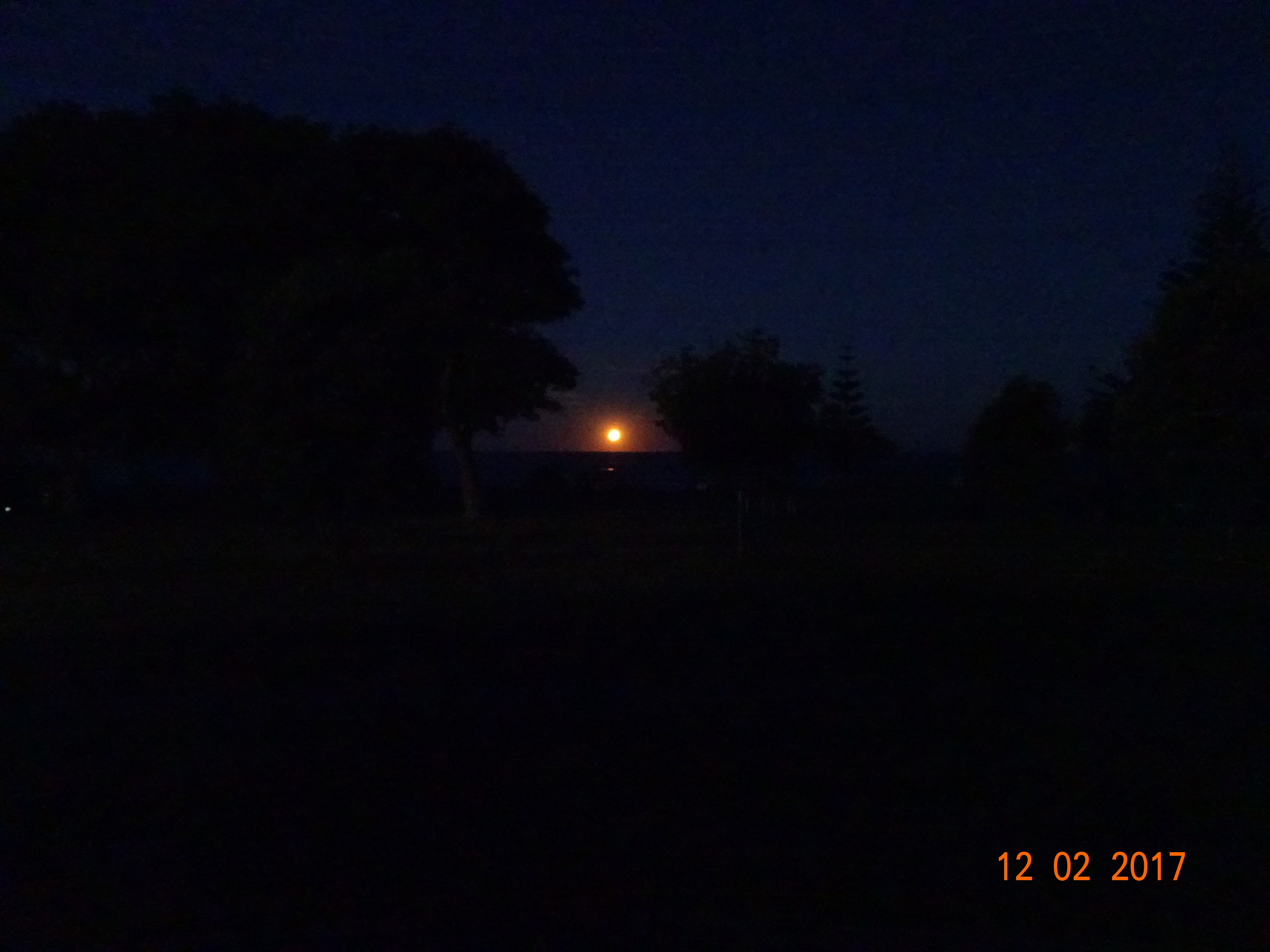
The sun appeared on the horizon at 6:33, as planned, and we duly recorded the moment for posterity. Five minutes later it was behind a cloud (the sun, not posterity). Just to be fair, we’d snapped the moon the previous evening as it was lovely. The photos don’t do justice to either event.
Sunrise over GisborneMoonrise over Gisborne
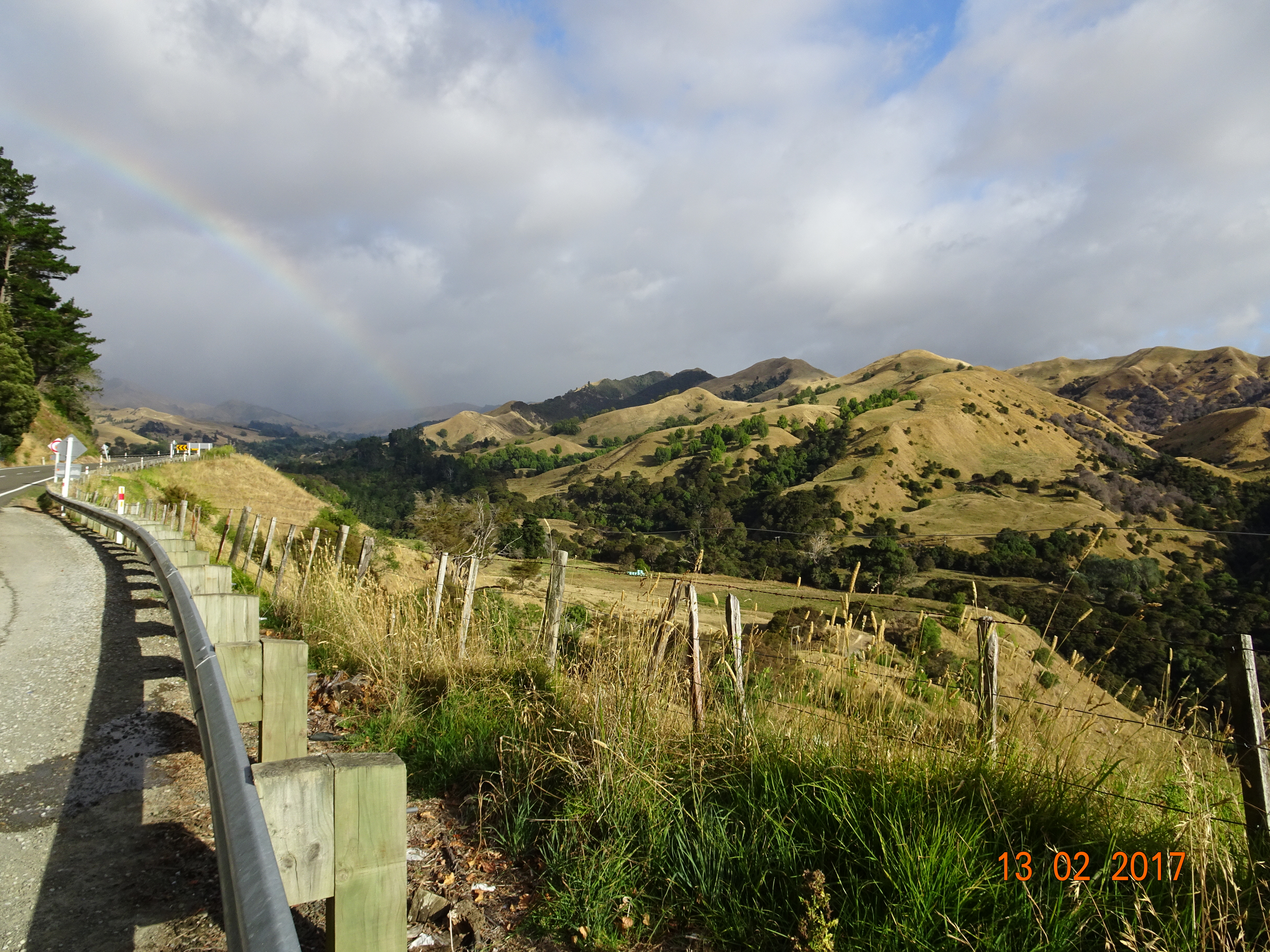
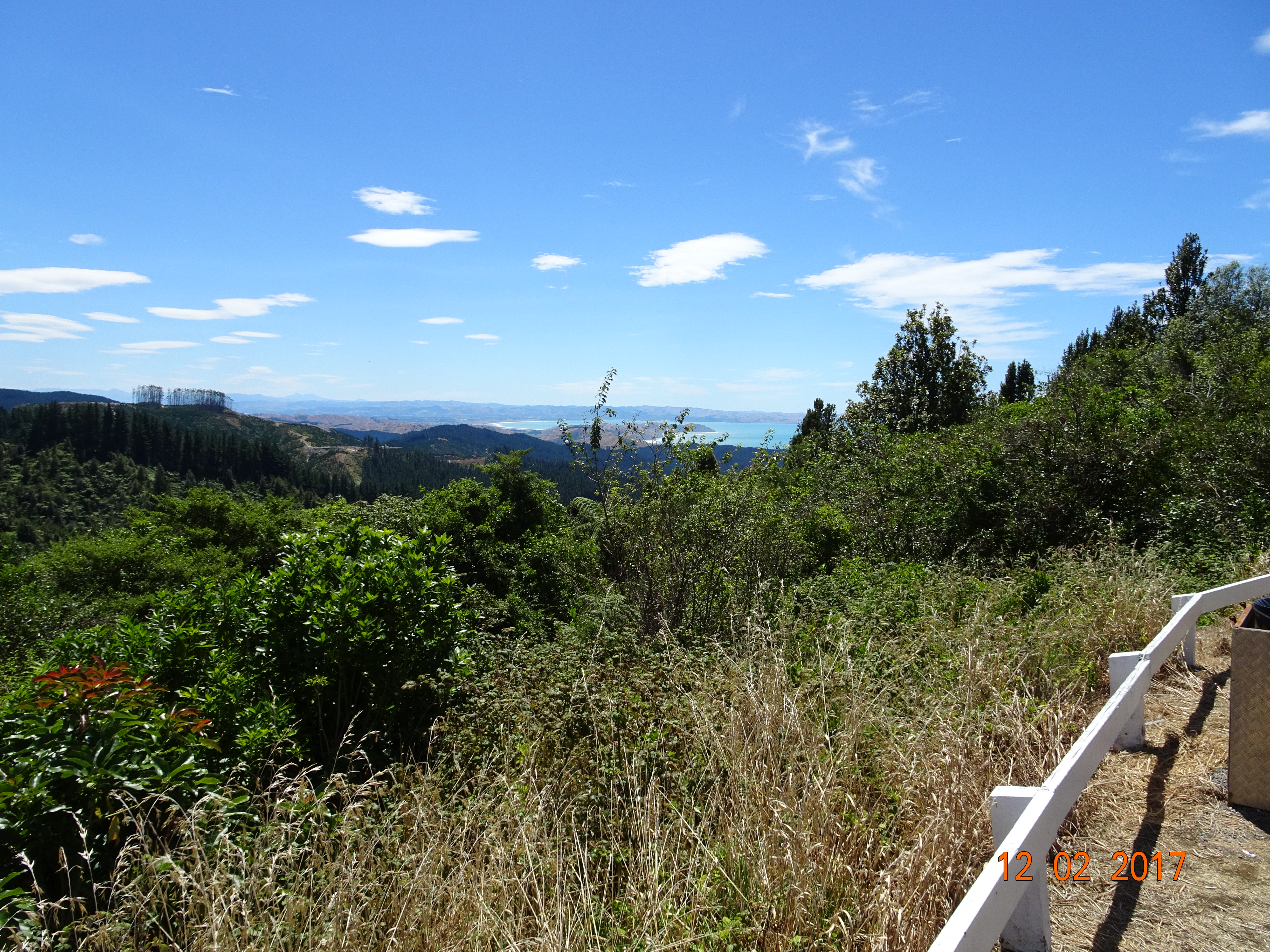
Then we were back on SH2, which swings inland to follow the Waioeka Gorge, while the Pacific Coast Highway takes the scenic route along the coast. For a long time we were aware of climbing gradually but with fields or woodlands on either side of the road there wasn’t much to see. The we suddenly found ourselves looking out over the countryside, with a rainbow for company. As you can see from the photo, the land is very dry as there’s been no rain. But where we go, so does the rain, so this will be green by tomorrow.
Unlike previous passes, there are very few hairpin bends. Most of the time there are long, sweeping curves, as the river meanders between the mountains on either side. It really is quite spectacular. And wearing if you’re driving. When we were in South Island, we came across picnic places, towns and villages regularly along the route, so there were plenty of opportunities for a break. This hasn’t been true of North Island, at least as far as SH2 is concerned; most places seem to have been bypassed, so finding a coffee or meal isn’t easy.
We swapped SH2 for SH30 at Awakeri and headed west towards Rotorua. The road skirts the southern shores of lakes Rotoma, Rotoehu and Rotoiti, giving brilliant views of all three before tracing the eastern shore of Lake Rotorua, the largest of them all.
The town itself is a bit of a tourist resort – so tomorrow we’re going to be tourists!
So we thought since it was Sunday we’d have a rest day at Napier. Then we realised it was Saturday but we had the rest day anyway!
The campsite we were in was one of the most expensive so far and there was a lot of noise overnight, so we moved to a small, privately owned site that we’d been told about, at Puketapu in the hills above Napier.
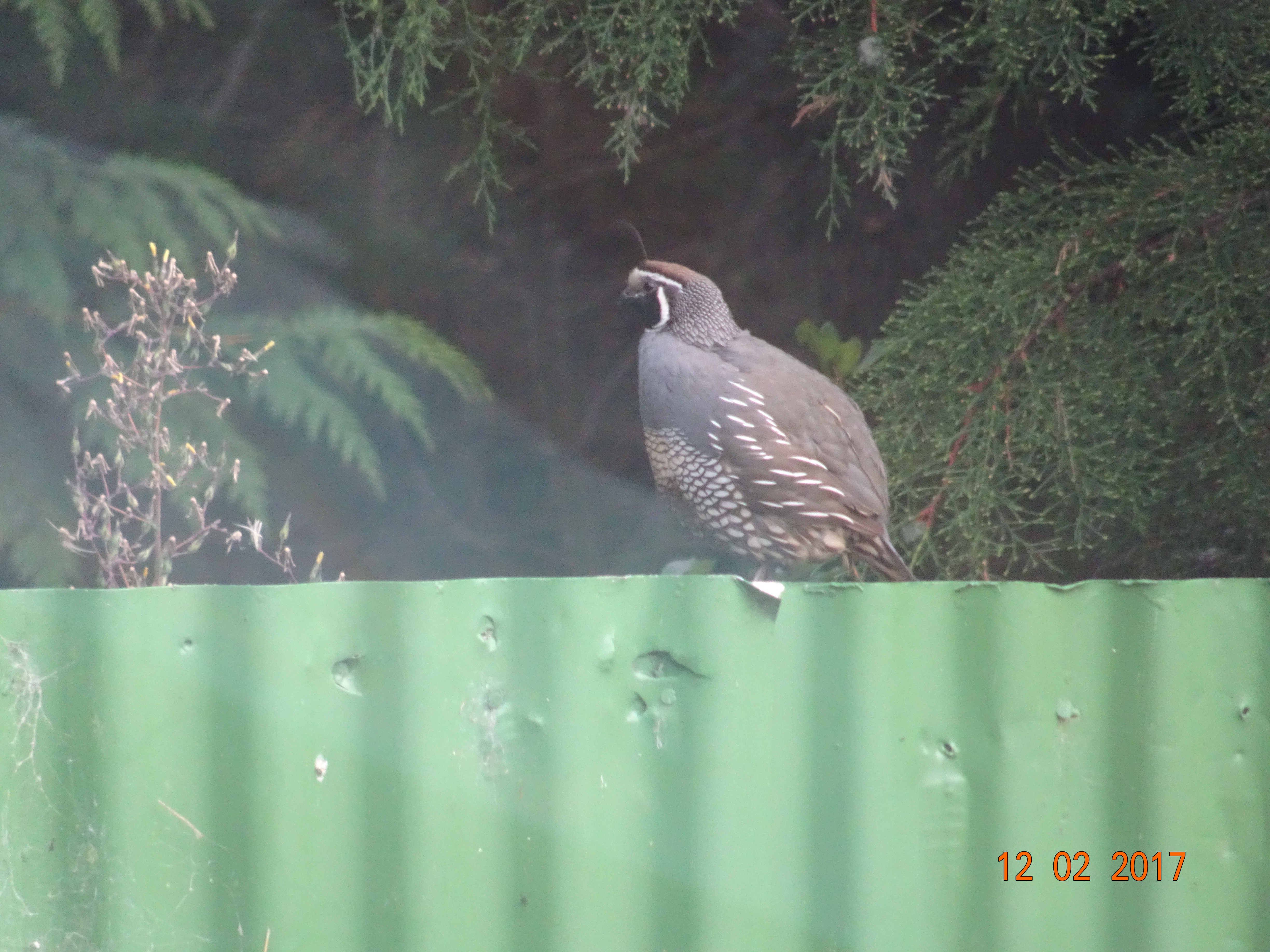
As we were about to turn into their gate, five or six birds went running across the road in front of us, accompanied by a tiny one, no more than a couple of inches tall. We found out later that they were quail, and that there was a family of them living at the back of the site. Later that evening, they all came out to feed in front of Ermintrude.
That afternoon we got involved in a game of Kubb. This involves 10 little blocks of wood, one big one and six batons. It’s kind of a cross between Aunt Sally and bar billiards. I’ve no idea what the rules are, but see here for a summary.
Next day we were back on the SH2, or Pacific Coast Highway as it’s called at this point, to make our way to Gisborne. As always, there are plenty of winding, hilly roads, but we passed increasing numbers of sweetcorn fields and fruit orchards. You still see plenty of sheep and cattle, but there were also quite a few herds of goats.
Approaching Gisborne we had a great view down into Poverty Bay, where Captain Cook made his first landing in 1769. We also passed Young Nick’s Head, the first land sighted, named after Nicholas Young, the cabin boy who first spotted it.
These days Gisborne is known as the Chardonnay Capital of NZ and is also the first city in the world to see the sun each morning – assuming it isn’t cloudy. We’re currently parked at our campsite by the beach facing the sea, hoping to be the first people to see the sun tomorrow. Well, us, the rest of the campers and 36,100 Gisborne residents.
From Masterton we continued north on the SH2. The countryside seemed to be a lot gentler than before, mainly flat fields and the odd bit of woodland. And although the mountains are never far away, the inclines are gentler too. It is also noticeable that the towns we’re passing through are larger than those we came across in the south.
Another characteristic of this area is that there are few picnic sites at the roadside; they are all signposted off the road. In the end, we followed one of the signs and ended up in a village called Norsewood. The streets had names like Hengist Street, Odin Road, and Viking Street, which roused our curiosity.
Every place we’ve been to has a museum, and Norsewood is no exception. The main difference is that their museum is all around the village; many of the buildings carry notices telling you their history. Apparently, back in the 1870’s, it was decided that this would be a great place for Scandinavians because they were “experienced farmers and woodsmen accustomed to frugal living and hardships”. The first two boatloads of immigrants were mainly from Norway, and the village still retains a Scandinavian flavour.
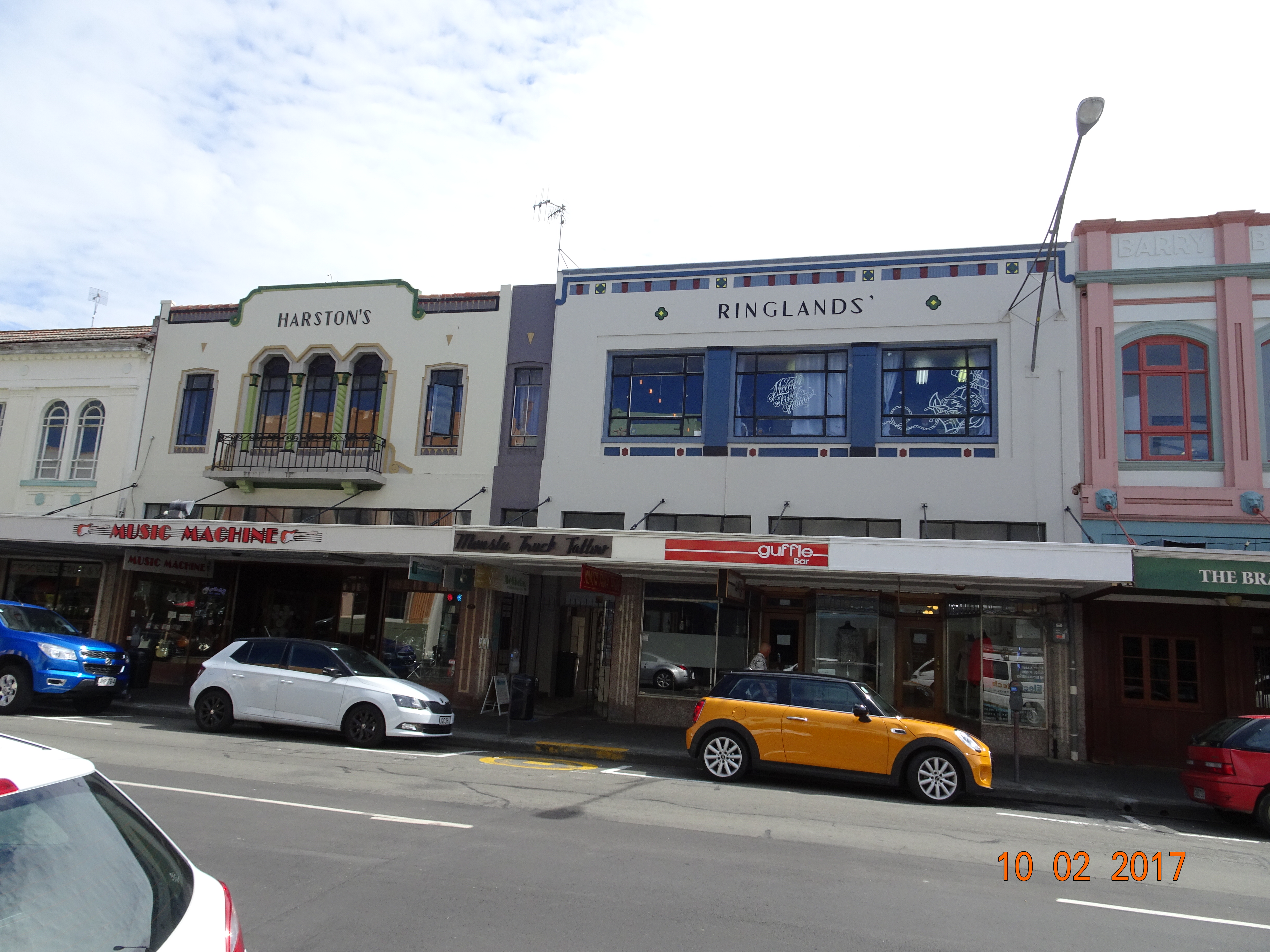
Having solved that mystery, we continued on to our main destination for the day, the city of Napier in Hawkes Bay. After checking in to the Kennedy Park Resort, we set off to walk into the city centre to see what the “Art Deco capital of the world” looks like.
The centre of the city was rebuilt in Art Deco style following an earthquake in 1931, hence its title. The style is concentrated in a fairly compact space, which is also a shopping area. This means that with a lot of the buildings the bottom half is a modern shopfront, but the top half is 1930’s style.
It was when I tried to take a photo of one of the buildings that disaster struck. The memory card was full. But when I tried to look at the index there was nothing on the card. Courtesy of the tourist information place we made a bee-line for the nearest camera shop. While waiting for the owner to be free, I noticed they sold memory cards and it occurred to me that I didn’t know where the card is in my camera. Eventually I found it, took the card out, put it back in again and the camera was fixed! I thanked the owner for his help and we left!
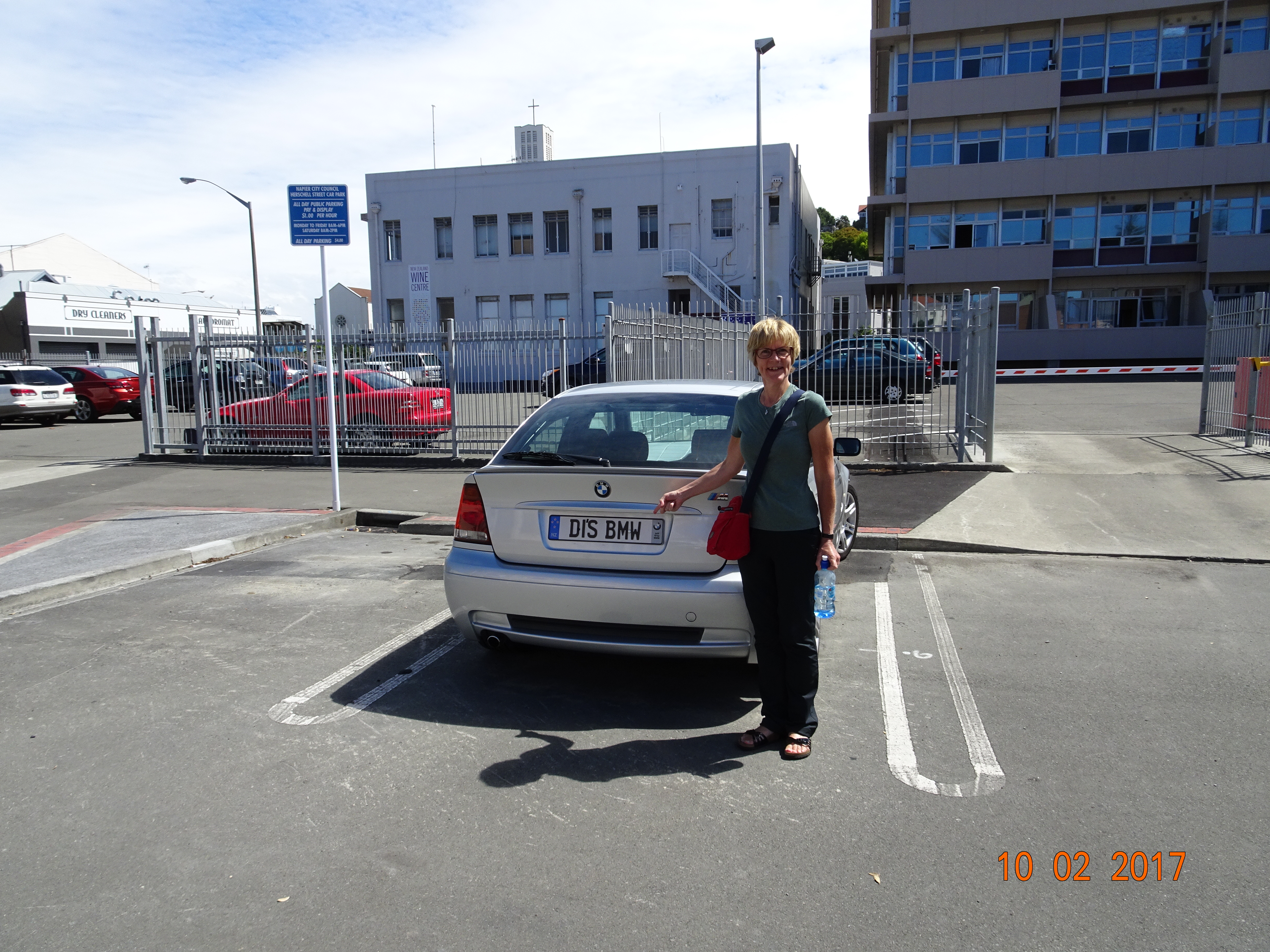
A lot of Napier seems to close at 4pm, but we had time to visit Creative Arts Napier – CAN – where Diane found her new car, view the very modern Anglican Cathedral and indulge in a smoothie and cookie each.
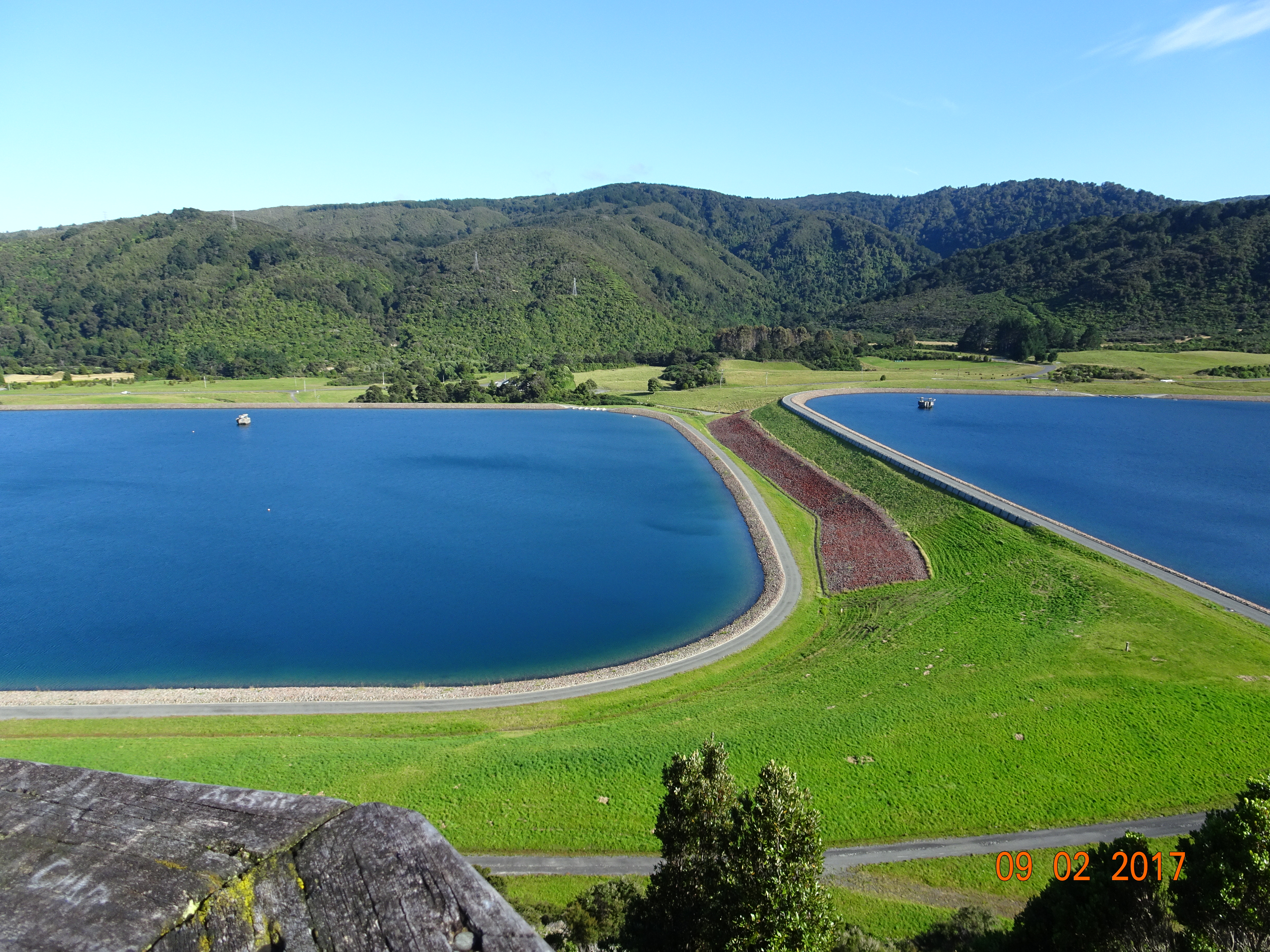
As soon as we got back onto SH2 the road started climbing, and within five minutes of Te Marua we stopped at our first viewpoint. Pushing through some bushes we came out on a platform above the Macaskill Lakes, the reservoirs that supply Upper Hutt’s water. And, as you can tell from the photo, the sun was out!
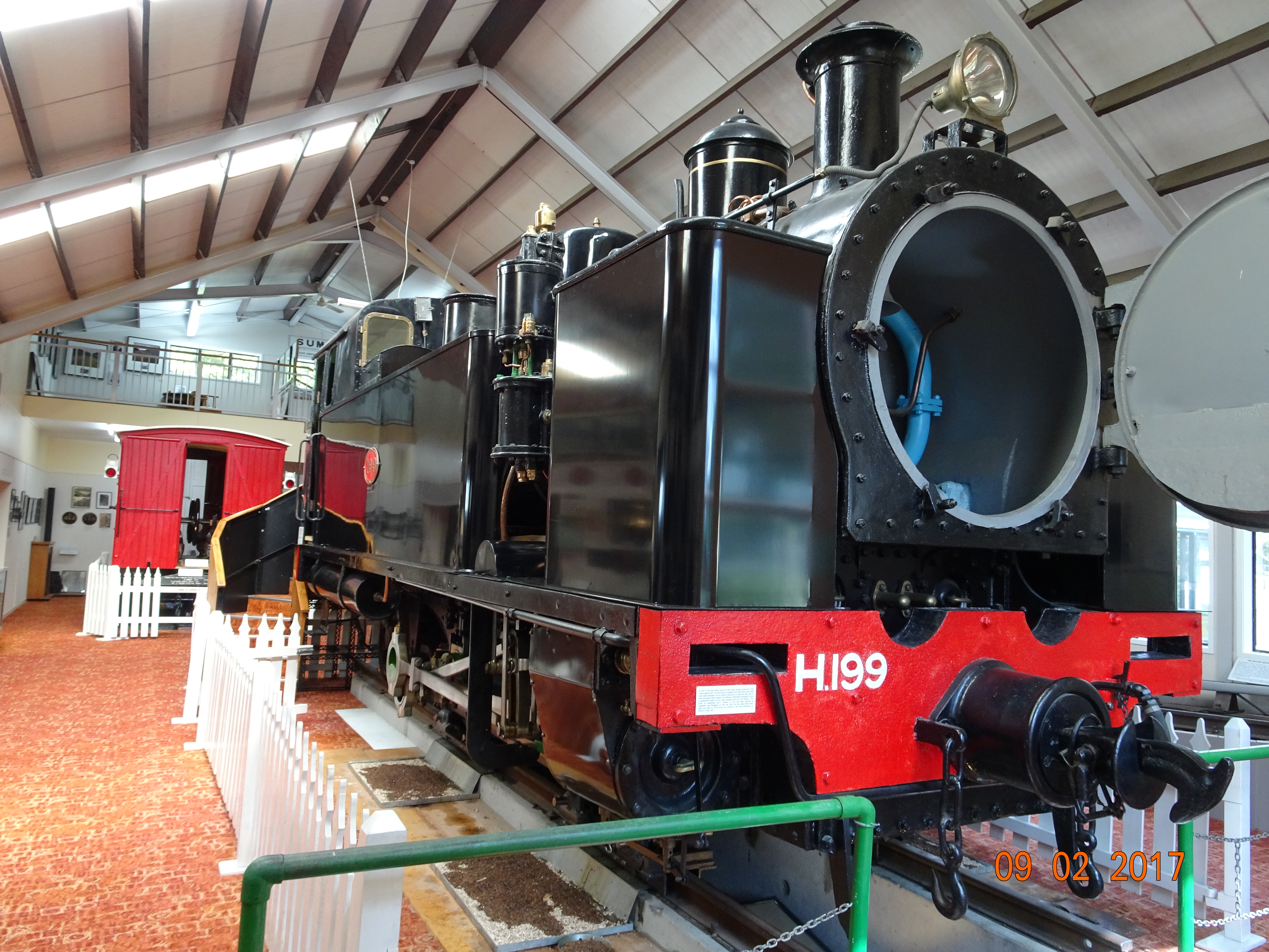
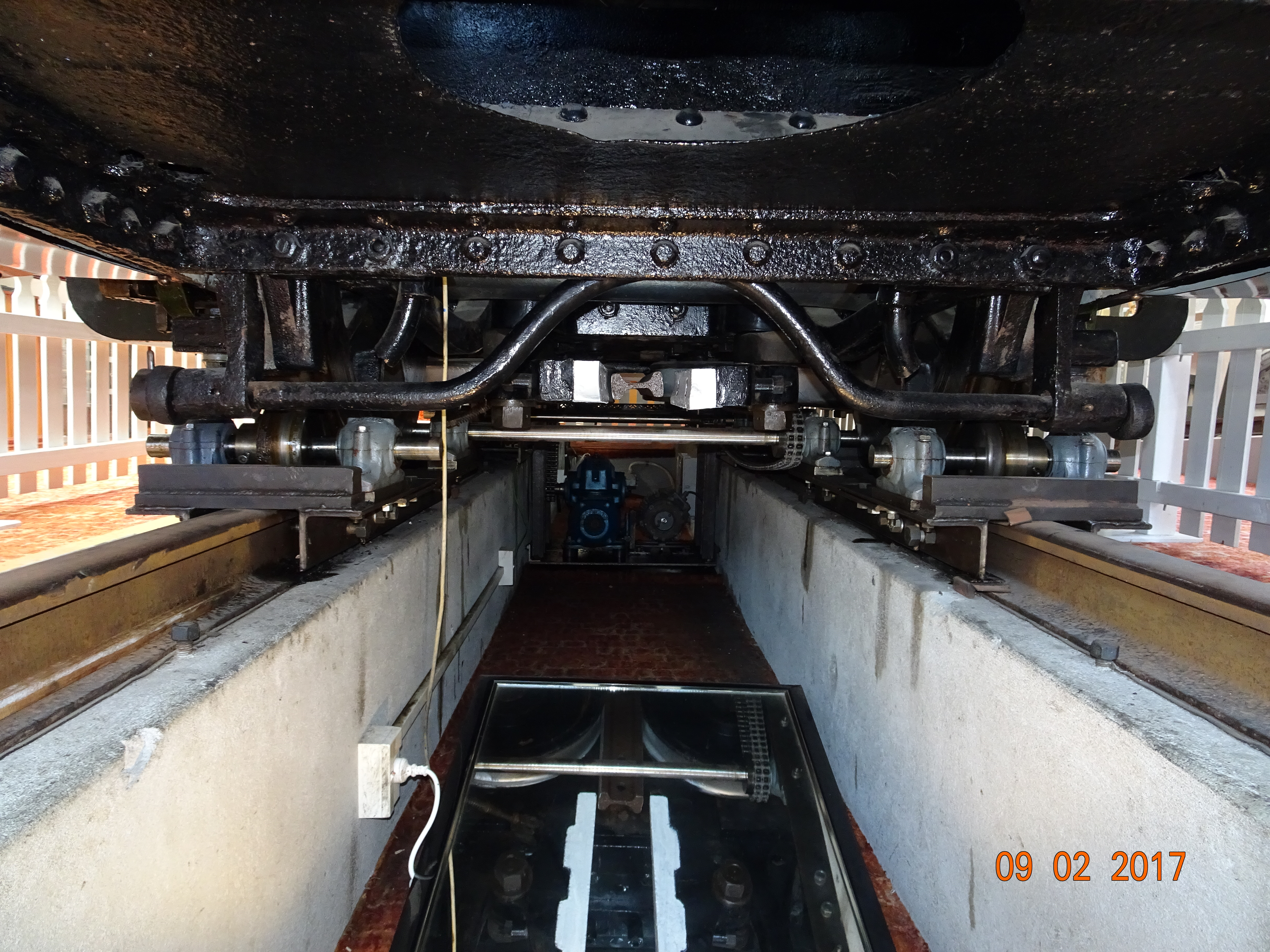
From there, SH2 winds through the Remutaka pass between the Taraura and Rimutaka mountain ranges until it comes to the Wairarapa Valley. We were aiming for Featherson to visit the Fell Locomotive Museum. Like the cable car museum yesterday, this is built round one main exhibit, in this case H199, the only remaining Fell steam engine still in existence.
Designed by John Fell, this was a system for getting trains up and down steep inclines. It used a third rail that was gripped by four internal drive wheels in the locomotive to provide stability and extra power for going up the incline. It was also used for braking when going down the incline, with dedicated brake vans being attached to the train. They went through a set of brake blocks on each descent.
The internal wheel mechanism
These locomotives were used from the 1880s until 1955, when a tunnel through the mountains was built. As well as looking around H199 and a restored brake van, the two of us sat in splendid isolation in their little cinema to see a short film about the line. The whole place was very interesting and informative.
After that, we drove to Masterton and checked in to the Mawley Holiday Park. We took a short walk along the riverbank and then into Queen Elizabeth Park, before visiting Aratoi, the Wairarapa museum of art and history. The museum specialises in modern NZ art and exhibits some fascinating pieces. And some strange ones!
Needing to take a bus to Upper Hutt then a train to Wellington, we checked the Metlink site to work out our options. Then we took a walk out of the campsite to check the location of the bus stop. After all our research, we decided that getting an off-peak ticket would get us into Wellington quite late, so we’d splash out on the full price – an extra NZ$3.
So there we were next morning, waiting at the right stop, when a bus coming the other way stopped and the driver waved us over. Thinking we were in the wrong place after all, we hurried across the road and got on. It turned out that there had been a collision between two logging trucks on the highway and the route back to Upper Hutt was closed. But he was very proud of the fact that it hadn’t delayed him.
However, by the time he’d called his wife to warn her to take a different route to work, shown us the photos he’d taken as he came past the scene the other way and picked up a girl waiting for a school bus because there wouldn’t be one along soon, we hit the highway five minutes late!
Then we caught the back of the queue and there we sat. It took over an hour to get to the station, and we were just in time to catch the first off-peak train!
The first thing we noticed when we left the station was that Wellington is the citiest city we’ve been to since we arrived in NZ. There were high(ish) rise office blocks and smartly dressed people everywhere, wearing lanyards and id cards and carrying laptops and files. The coffee bar we went to was full of business people having meetings or networking.
We headed to Te Papa, the national museum of New Zealand, a very modern looking place in the Waterfront area of Wellington. Everyone we’ve spoken to has raved about it and Diane was particularly interested in seeing the exhibition about the Treaty of Waitangi, NZ’s founding document. It was fascinating, but we were disappointed that there was no context to the exhibition. Perhaps if you’re from NZ you know all about the tribal wars and other events alluded to, but it just left us with more questions than answers.
Te Papa Tongarewa
The same was true for an exhibit about more recent migrations of Pacific people to NZ. We did have fun watching from the fourth floor as loads of camper vans and motor homes went round and round the car park looking for a space. Perhaps the people who laid out the museum should ask them what they think of it.
Leaving there, we realised it must be lunch time by the number of joggers in the street! We walked off to the Cuba area, which seems to be the Bohemian part of Wellington to have lunch at Fidel’s café, as it has a good write-up in Lonely Planet. Such a good write-up that there weren’t any tables available. We settled for a very nice Malaysian down the road; NZ$20 for two curries in the middle of any capital city can’t be bad.
After that we had a choice; walk up Mount Victoria for the 360 degree view or take the cable car up from Lambton Quay to the viewpoint at Kelburn. We opted for the cable car, which is really a funicular railway now, but what’s in a name?
At the top, apart from the photo opportunities and tourist café, there is a cable car museum. This tells the story of the cable car and even has one of the original cars in the middle of the room. First opened in 1902, it was originally a cable car, with the cable winding gear driven by steam. There are three bridges and three tunnels on the route, as well as three intermediate stations – the designer must have liked the number 3! Other than an electric motor replacing the steam engine in 1933 it ran more or less unchanged until 1973 when a workman stepped in front of a car and was seriously injured. The line closed in 1978 and the current funicular railway was installed, opening in 1979.
Cable car with a view
The museum was small but perfectly formed and very informative – Te Papa authorities, please note!
From there, we walked back down into the city through the Botanical Gardens and back to the station to make our (incident-free) way home. As the train went past the ferry terminal, we did happen to notice that the water in the bay was very choppy. Seems like we arrived on North Island just in time!
The following day was a public holiday – Waitangi Day, celebrating the treaty of Waitangi, which founded NZ – so we decided to have a day off too. The most energetic thing we did was to book a morning crossing to Wellington!
Next day we were up before sunrise to complete the 60km to the Interislander Ferry terminal at Picton. We were saying goodbye not only to South Island but also State Highway 6, which we’d travelled from one end to the other.
They load trucks onto the ferry first, then trailers and then motorhomes, so we were on quite early and grabbed a spot in the lounge at the pointy end of the boat so that we had a good view. We’d been told that the first hour and last hour are through quite spectacular scenery. They might well be, but we couldn’t see very much at all due to the low cloud/mist covering everything taller than the 7 dwarves!
At the beginning we seemed to have a series of coves on either side of the boat, and the water was very calm. However, after the first hour the land disappeared and the water was not so calm. At least not for Diane and me, as neither of us is very good on the water. I coped by burying my head in a book and Diane coped by staring at the horizon.
About 2.5 hours in and there were vague shapes in the mist ahead. Then suddenly we were in Fitzroy Bay and approaching Wellington Harbour. As we neared the dock, there was an announcement on the PA, but we couldn’t hear a thing because they chose exactly that moment to reverse the engines to slow the boat down! However, the lounges started emptying out, so we assumed it was about going back to the cars and we followed everybody else.
Fortunately we didn’t have to follow them for long; our lane was first to move when we docked and we were the fifth vehicle off.
After a quick grocery stop at Hutt City Pak ‘n Save, we made for Te Marua, to a campsite recommended by the owners of our previous site. It is a bit of a trek from Wellington, but there doesn’t appear to be a decent campsite in or near the city. This place is lovely, with plenty of space, very few people and great facilities.
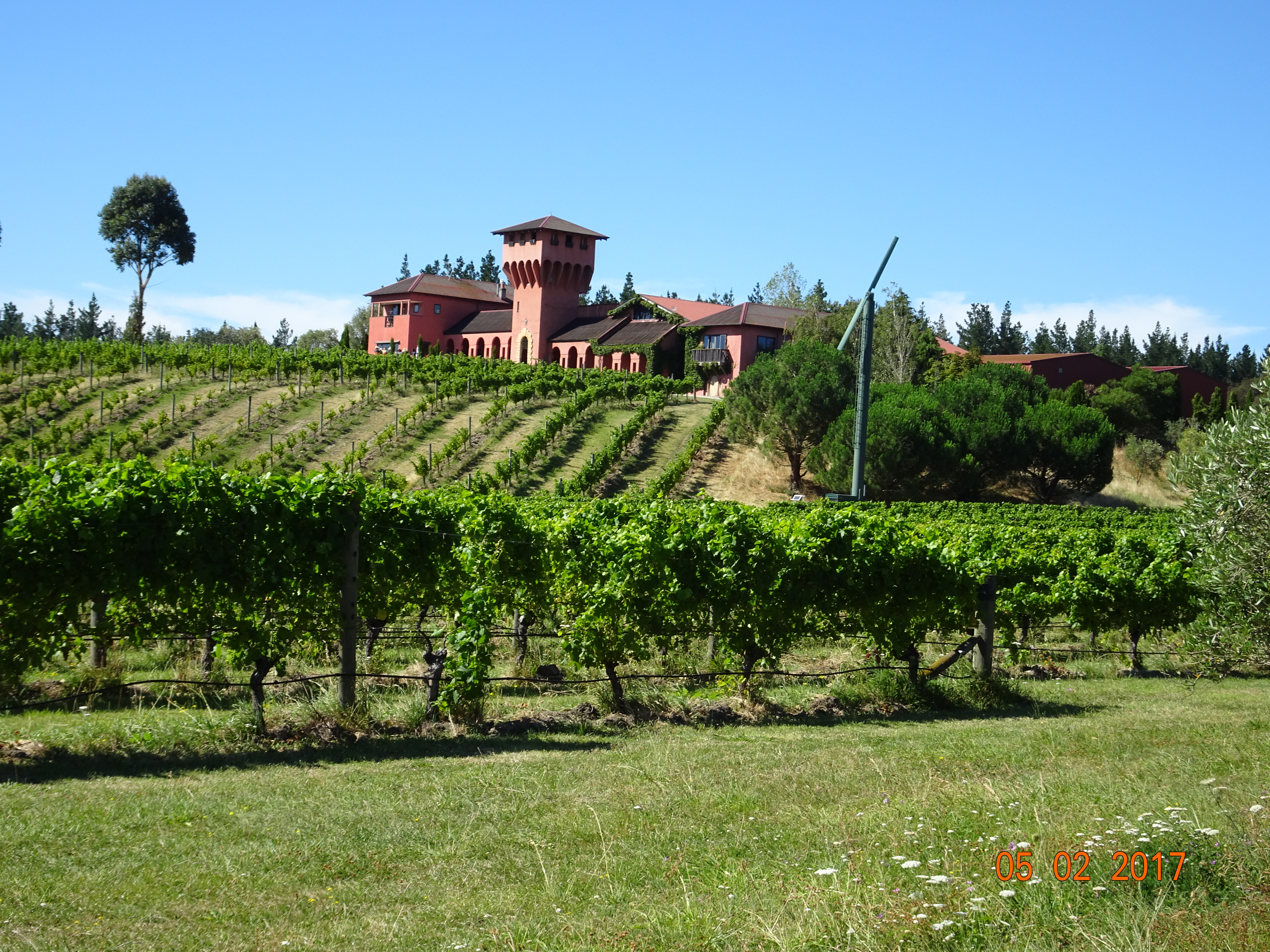
Leaving Nelson, SH6 was as spectacular as ever, this time with conifers on either side of the road. We were aiming for a small, privately-owned campsite in the Wairau Valley, just south of Blenheim, that some friends had recommended so that we could take in the Marlborough wineries.
The owners told us that there would be a social event as it was Saturday, so we joined our dozen or so fellow campers drinking wine in the sunshine. Great way to meet people!
The following morning, the owner picked us up to take us on our own, personalised wine tour. He does this for his guests in return for lunch and a contribution to his fuel – and he only has one glass of wine!
We started at Highfield Teravin, which is in a Tuscan style building, with a very knowledgeable guy who works there at weekends to finance his bachelors in wine making. In this area you have to try the Sauvignon Blanc, but we also sampled a sparkling rosé, a surprisingly good Chardonnay and an even more surprising Riesling, among others.
Highfield Winery
Next was Villa Maria, set in a far more modern, even minimalist building. Our host there knew just as much about the wines, but his spiel was rather too polished for my liking, and he had to keep breaking off as other guests came and went. But there were some good – and surprising – wines here as well.
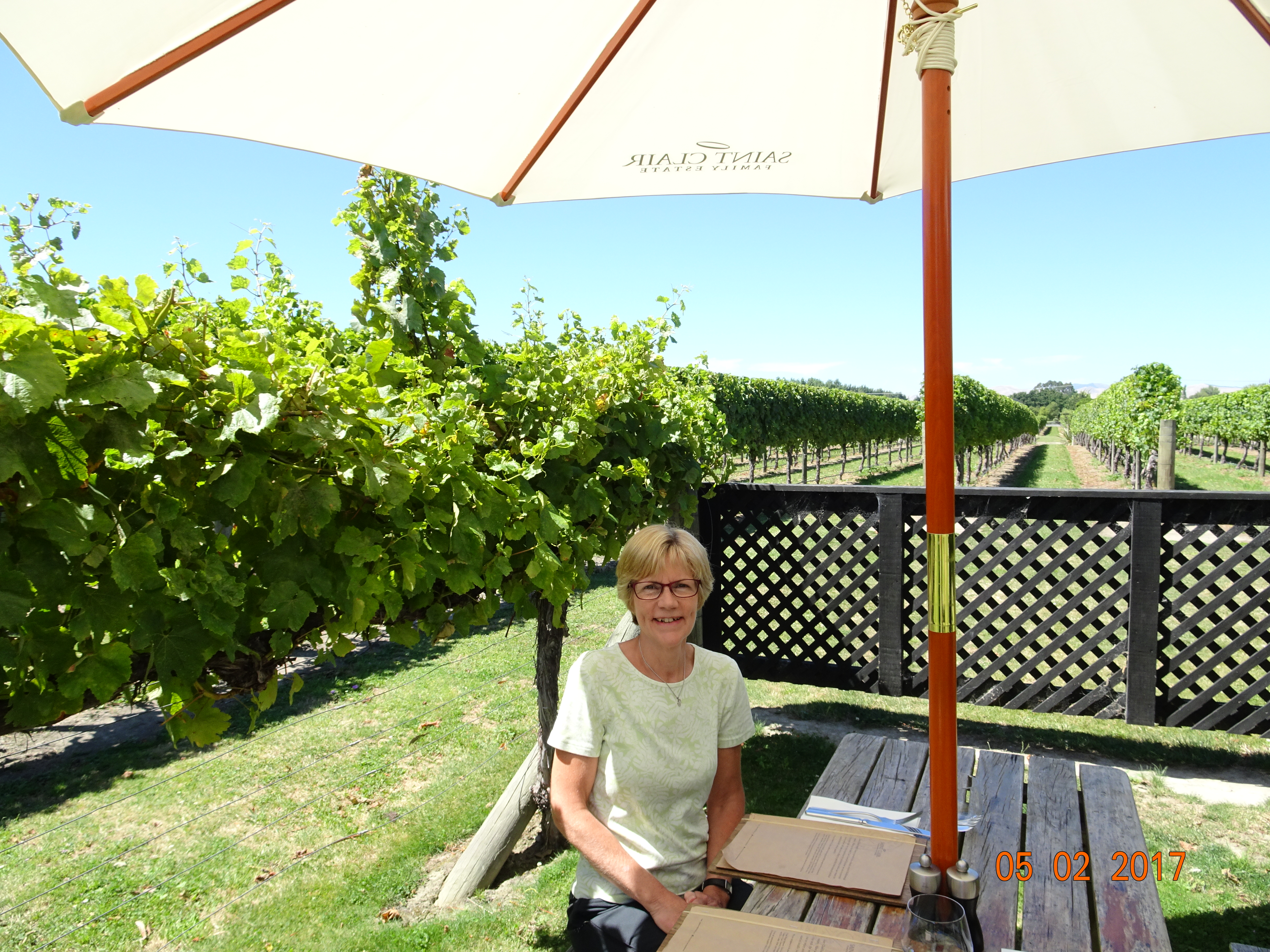
Our third stop was Saint Clair; we’d bought a bottle of their wine earlier in the holiday that we’d really enjoyed, so we were happy to visit them. The setting was again modern, but far nicer than the previous place. They also had a very neat system for storing and serving the wine. The bottles were all upright in what looked like a coffee machine, and the wine was automatically syphoned out at the press of a button. Our host here was a Brit who’s been here for six months; she has no background in winemaking, but was able to answer all our questions. We also had a very pleasant lunch here, in the sunshine at a table nestled between two rows of vines.
Lunch at St Clair
Hunters came next, in a little complex of buildings that also included an artist’s studio. The tasting here was done round a large wooden table – or it would have been around if it hadn’t just been Diane tasting the wine. Being unable to taste anything by now, I went for a walk around a little nature reserve at the front of their grounds.
Finally, we just had to visit Cloudy Bay. This had by far the largest tasting area – a long bar – and the most staff, but it was also the most expensive and commercial operation of the day. It was very impersonal and there was no deviating from the set wines on offer. We left with the impression that they were trading on their reputation.
An interesting day, and I think my find of the day was the St Clair dessert wine, a honey-flavoured Riesling.
Back at the site it was 30C, so time to sit by the pool and chill!